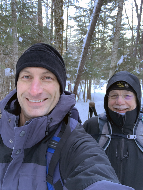
Sunday 31 January 2021 (See below for Hancocks on Saturday 13 March)
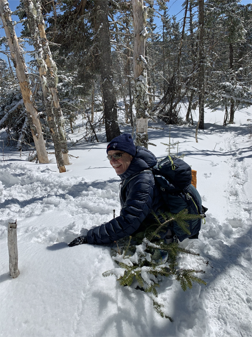
Our first winter hike without a guide. Less than eight miles out and back, never really above the tree line except for a brief moment to take in the spectacular views (if available) right at the peak, it seemed safe enough. We never got close to being tested, at least not by the weather. Having said that, we delayed our Saturday departure because Sunday was forecast to be much warmer. We were glad we did. It was -12F (-24C) at the base, warming to 12F (-11C) by the time we got to the top, and that was plenty cold enough.
 All photos and videos courtesy and © 2021 Ryan Grimard. Absolutely awesome, as always, thank you!
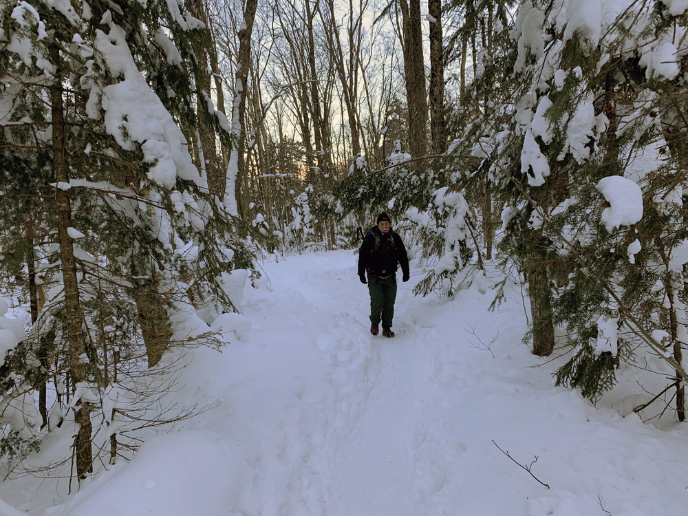
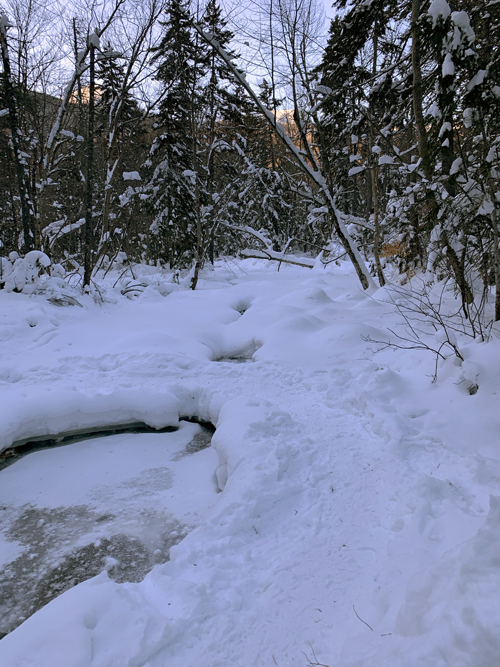
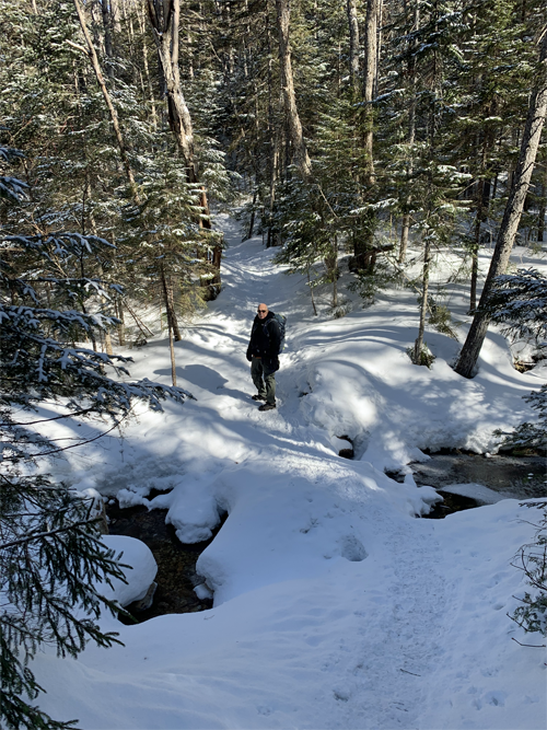
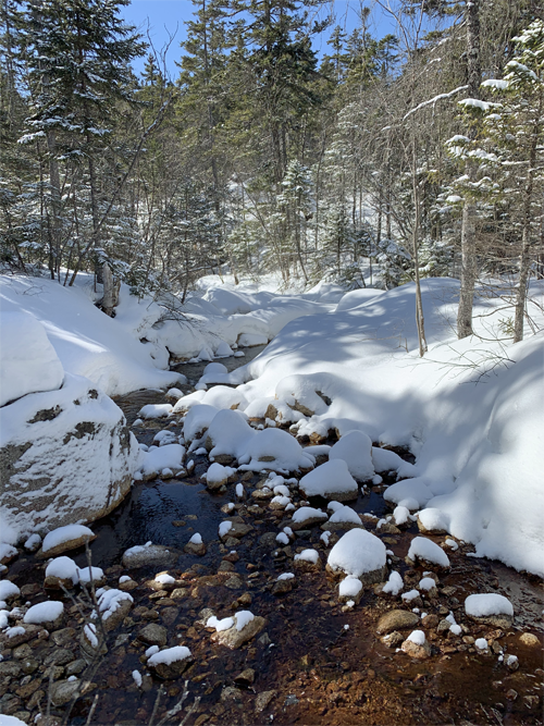
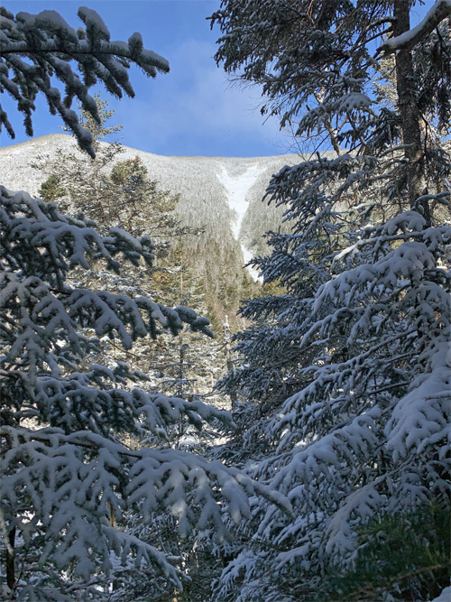
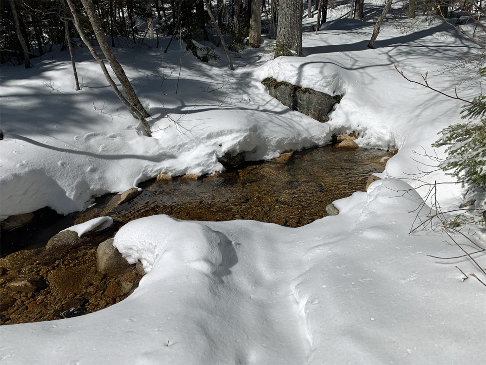
 The first mile and a half was a winter wonderland, a meandering trail along a valley floor, trees leaden with snow, countless stream crossings on ice or log bridges, or the occasional jump. A spectacular walk to bring a wider audience to enjoy, some other time.
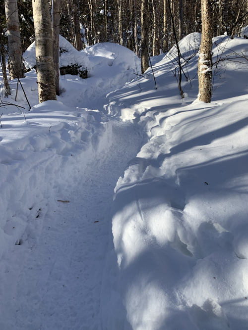
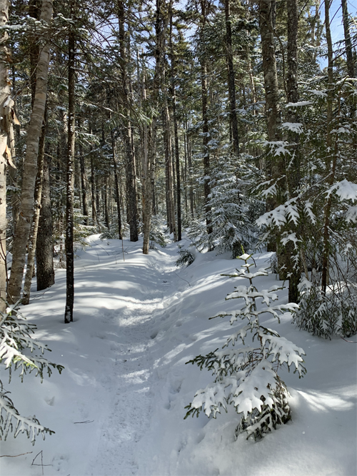
At about 1.3 easy miles, we came to the turn to take us up the mountain. Another hiker had stopped to put on snow shoes. Pause for thought: we'd deliberately left ours in Ryan's truck. We were very happy with our micro spikes, and both agreed (again) that our traditional snow shoes would not be good on these trails. The path was packed down to an 18inch wide and 4 to 12 inch deep groove. The micro spikes were in their element, and our snow shoes too wide for the track. The dozen people we were to meet during the day all sported more modern, narrower, plastic snow shoes that would fit in the groove.
This guy was no exception. He explained that he was working on "the grid:" doing all 48 4000 footers, in all 12 months of the year: 576 peaks altogether. A little humbling, but who has the time? We've got other things to do! Despite his obvious experience, we were still confident that leaving our wide shoes behind was the right move and that that we were as adequately equipped as we could be. We left him to his straps.
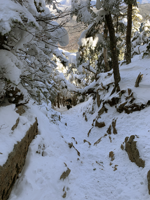
It did not take long for the gradient to increase, and then increase much more. The last half mile to the first peak, East Osceola, is reputed to be some of the steepest trail in the Whites. We now no longer doubt it. We started stripping off layers, knowing that the biggest danger we faced was getting cold in sweaty clothes. Before long Ryan was in a T-shirt and I had a couple of layers on. No hats. I put my gloves back on because I was spending so much time with my hands in the snow bracing myself.
 The silence was deafening. No planes, no wind, no Harleys, no birds, and most of the time no other people. When we stopped there was absolutely nothing to hear. When we moved, it was just our huffing and puffing, and the squeak and crunch of the snow and ice underfoot.
Eventually it was so steep the micro spikes could no longer cope. I missed the toe spikes of full crampons. Without them, having kicked a toe in, it tended to slide back down to where it started. And you did NOT want to slip any further than that. There was not only the danger of injury if you lost control, but it was unthinkable that the hard-earned ground would have to be regained. It was like flight after flight of steep stairs. After an all-out push to climb the 15 to 30 ft of a flight, there would be a small landing, a patch of slightly more even ground where you could get your breath back before the next one. Even Ryan was happy to rest each time. Snow shoe guy caught up with us. No, he did not want to pass. "I'm happy having you pace me." So after several more flights he was right behind us to tell us that the landing we could see at the top of the next flight was the end, and that we definitely needed to take the right turn leading to an outlook, no matter how tired we were. So glad he made us do that.
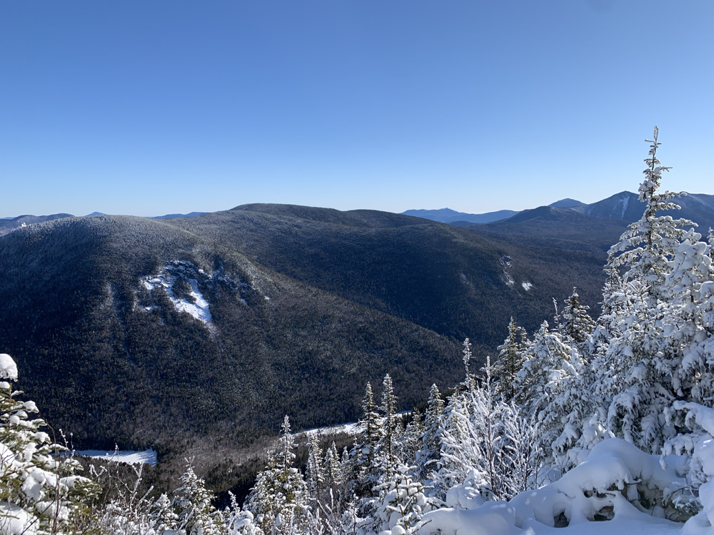
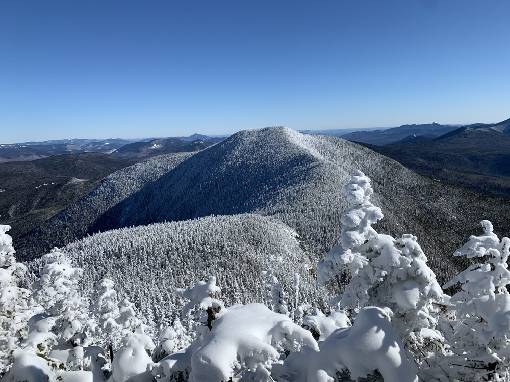
 The view from the lookout. On the left is the actual peak of East Osceola. Then the saddle and then finally at the back, the exposed summit of Osceola.
"The end" of course was not the top, but it was a great relief to be able to go more than 30 steps without needing to stop to rest. I was so tired I seriously wondered if I could take the second peak. The problem with out and back routes is knowing that every step has to be retraced. Snow shoe guy left us to ponder. What we pondered most was that despite our efforts, we were both soaked to the skin. Wet clothing freezing is one of the easiest and fastest ways to get into life-threatening trouble. But it was what it was. We were here now. The way down was going to present the same issues if we turned around now or we turned around in a couple of hours when we got back here. Worst comes to worst, we vowed that the second either of us started to feel cold, we stop and strip off the wet layers and put everything else back on. Space blankets and all if need be. Meanwhile, at the very least we had to summit East Osceola before we made any other decisions.
East Osceola was an average summit, just a small clearing off to one side of the trail. Osceola-the-main-event beckoned on the horizon looking up the trail. Only another mile, but then another mile back, just to get right back here. If we turned around, we'd have to do all this again to take it next time. That was way worse. All this was going on in my head, not Ryan's. Having looked and sounded as beaten as I was by the climb, in these short few minutes he'd bounced back to his normal energizer bunny self. Nothing more to think about. We suited up and moved out.
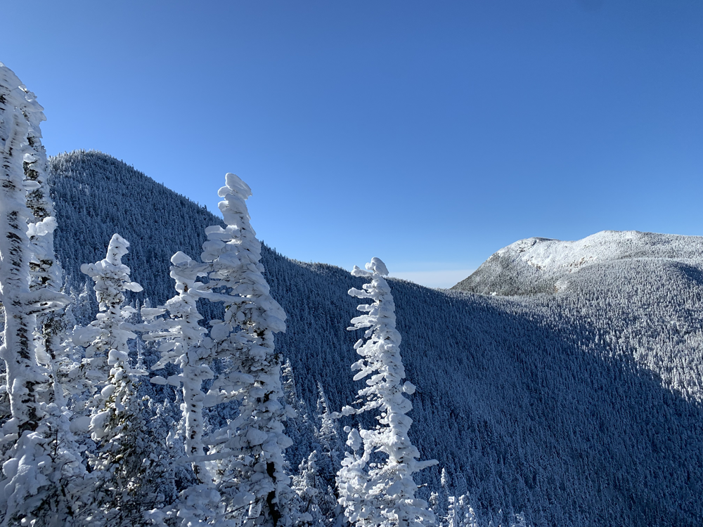
 Half way up the saddle between East Osceola and Osceola, looking back at East Osceola.
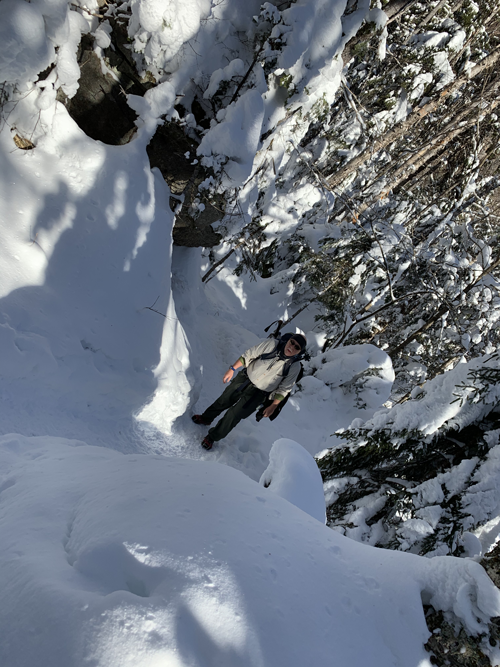
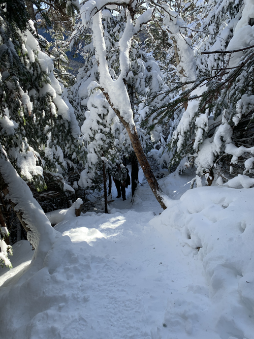
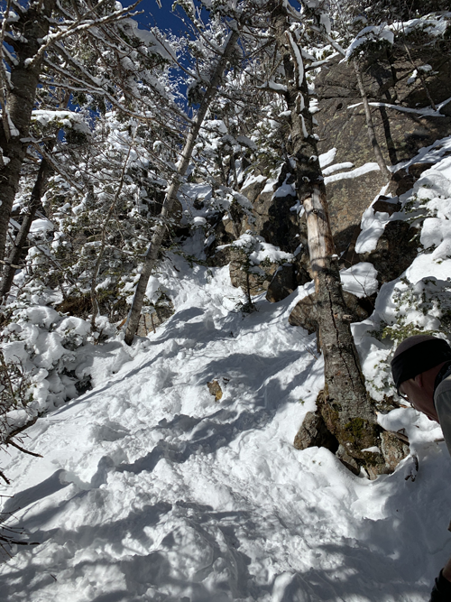 Before long we arrived at The Chimney, a section of trail so notorously steep that guidebooks note an alternative route off to its north. I'd rather hoped we passed it without noticing on the main ascent. It was indeed nearly vertical, and comprised huge boulders stacked up like a column of sugar cubes. But it was only about 25ft high. Ryan had no qualms about tackling it, but since there was an escape route, I saw no point in tempting fate so I went around, and in 60 seconds met back up with Ryan at the top. There were a couple of slippery descents down into the saddle but nothing crazy, and in half an hour we were on the top of Osceola.
Left: The Chimney. It looks easy enough in the photo because the camera is pointing uphill. Look at the angle of the trees.
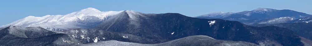
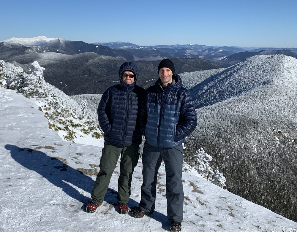
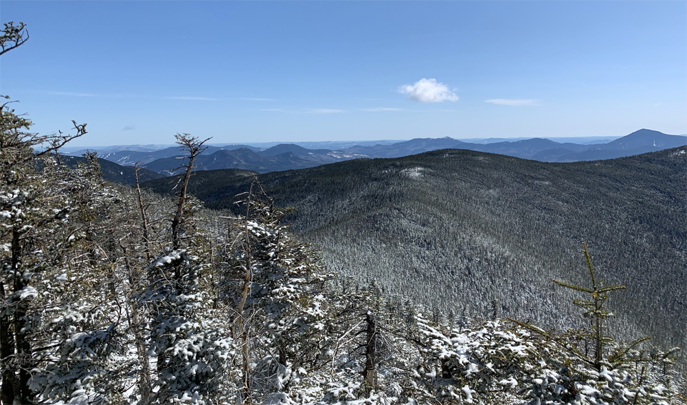
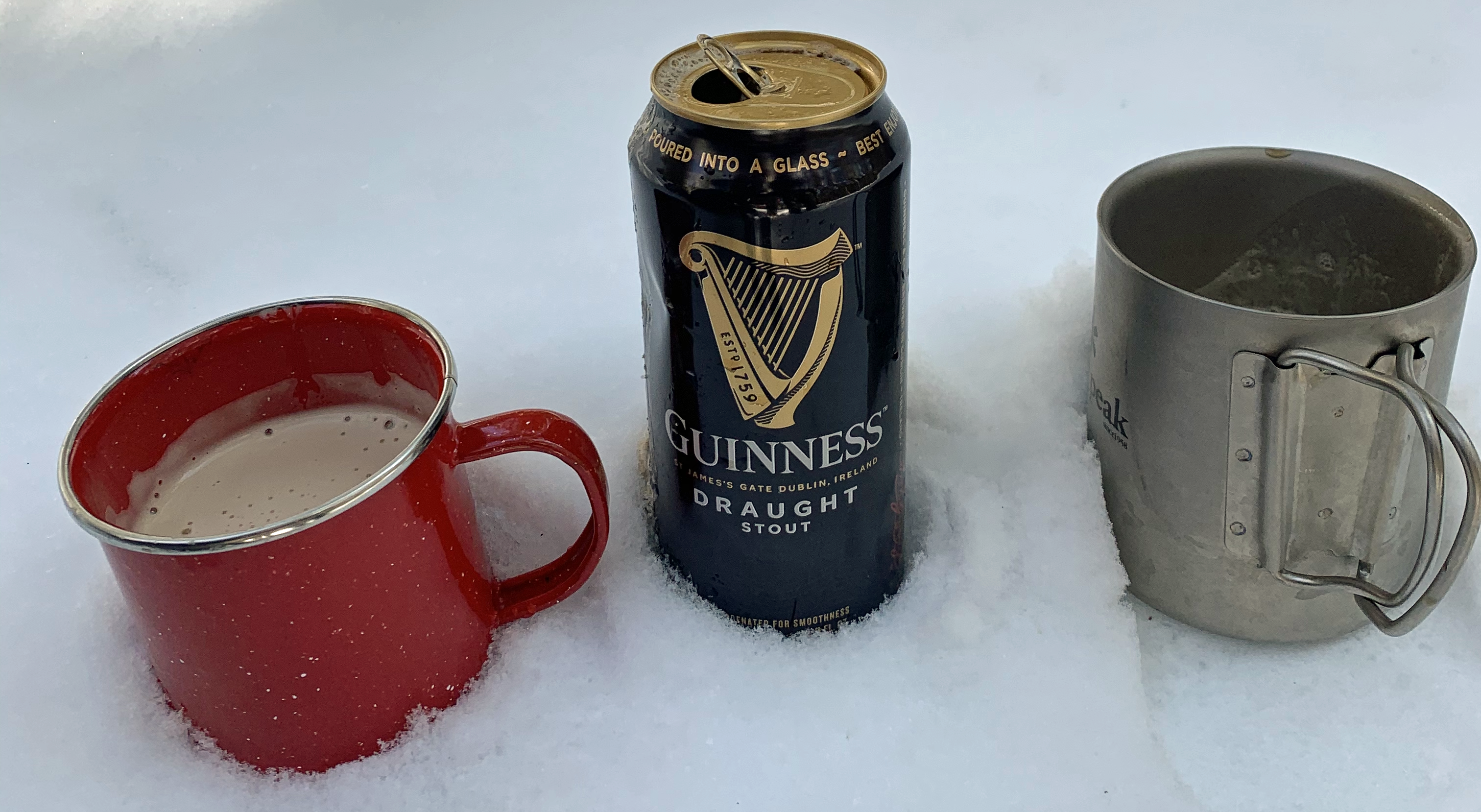
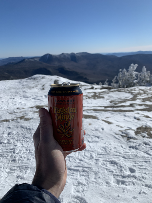 It was just the tired legs talking. Once we were on Osceola's summit, all was forgiven. An instant favorite peak. Absolutely breathtaking views, with no wind and wearing our fat boy overjackets, the 12F was a complete non-issue, and several other groups were also enjoying the sun and the view as they picniced. We were reminded how infrequently we've been able to do that: just sit and enjoy lunch. Ryan pulled out a couple of beers. Whataguy. I'd brought bread, cheese, sausage and tomatoes. A pair of fellow travellers sat near us saw the beers, and saluted us by getting out their own supply of Glenlivet. They had caught up with us just as we returned from the outlook, so we were able to pass on the recommendation, then they came passed us again like we were standing still, which we almost were. Now we were lazing over lunch I could see that one had full mountaineering boots and crampons, which I'm never going to justify, but the other one appeared to be wearing regular hiking boots, but also appeared to be wearing crampons instead of the micro spikes we (and others) were wearing. I thought this was a contraction in terms: crampons only working on full-shank, rigid boots. They confirmed that I was correct, but that there was also this sort-of compromise: something beefer than the micro-spikes and with the all-important front-facing teeth, but with a flexible spine so they worked on regular boots. I resolved then and there to track down this fabulous compromise and if they were remotely affordable, snag me a pair.
We helped each other gets these great shots, then it was time to pack up and head for home. The rest, the views, the silence, the splendid company (old and new), knowning that The Chimney did not pose any sort of threat, completely transformed my attitude. Instead of worrying about how far we had to go, I was thoroughly looking forward to retracing our steps across what we could see, the saddle over to East Osceola, and then it was downhill all the way.
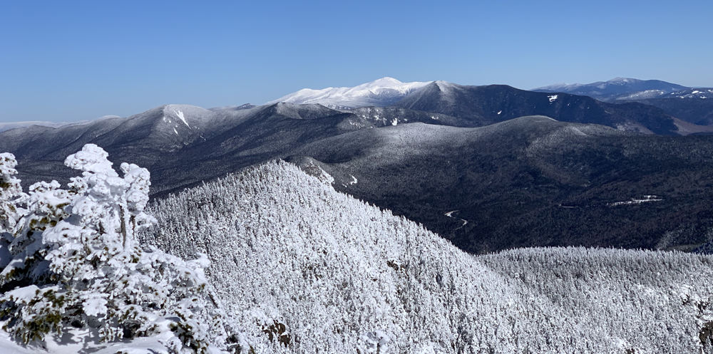
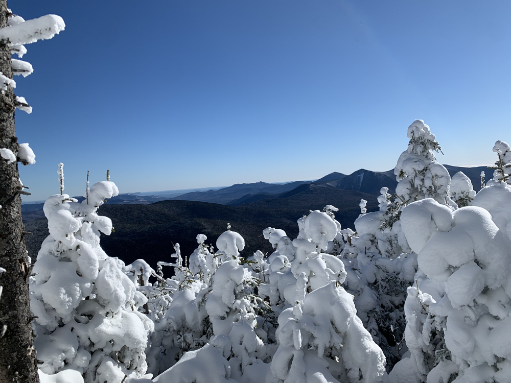
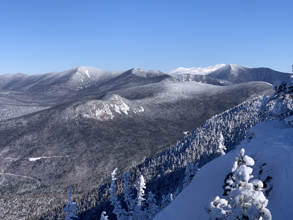
 Osceola. On the right East Osceola and home. On the left, in the far distance Mount Washington.
We suddenly started passing people still on the way up. That always makes me feel good too. Half in micro spikes, half on the narrow snow shoes. Once again I by-passed The Chimney and got to the bottom just in time to see a guy mis-step at the top and take the whole section on his ass, bouncing off the last ledge and landing in a snow bank at the bottom. He got lucky. His pride was more bruised than anything else, and the snow bank prevented a serious escalation of the problem beyond it: we were in very steep terrain. His girl-friend witnessed the whole incident from the top, and decided that on reflection the wimpy route they'd watched me take had its merits.
On down to East Osceola, now even more unassuming when compared to the glories of Osceola itself. Soon enough we were back at the top of the main ascent. I started to ponder whether it was better to turn around and descend as on a ladder, or hope that digging ones heels in would be enough. The scary part of such steep grades is that if you do trip over, it's a very long way from where ones head is at the start to where it will be when it finally hits the ground. I'm not sure what inspired him to do it, but it was a stroke of genius. Ryan took one of his micro spikes off, crouched down on that foot, and started sliding down the mountain using the forward-facing leg as a rudder and break.
I didn't need an invitation. This was clearly the solution. Glissading! BG and I had been taught it on our first winter hike, but it was more a token gesture. This was the real deal. Time after time we walked a few paces to the next flight, then slid all the way down it. Check out Ryan's run above: a full 40 seconds! It was safe(ish), it was easy, and most important of all, it was a blast.
When the trail finally flattened out enough that we couldn't overcome friction anymore, there was only another five or ten minutes hike back to the first and last junction, and then the mile and a bit of fairy tale path along the valley floor back to the car in a little more than five hours. A record.
We drove back into Lincoln, and cellphone reception, and stopped outside our favorite burger joint to regroup. It was so early we hadn't really worked up an appetite, and Covid restrictions meant we couldn't go inside to enjoy the all-important beer, so what was the point? For the first time ever, we got back in the car and headed straight for home.
Saturday 13 March 2021 (See above for Osceolas on Sunday 31 January)
Our January jaunt was such a success we decided to try our chances with a second winter outing. The idea of knocking off peaks before the "season" even begin was hugely appealing. We settled on the Hancocks, (Hancock and South Hancock) as a similar distance and difficulty, and since they were literally just down the street from the Osceolas, similarly practical as a single day outing. Another couple were suiting up right next to us in the parking lot. I asked if they had hiked this route before. Of course they had. They didn't have to say anything, the looks on their faces said it all. "So do we go clockwise or anti-clockwise?" "Clockwise" they said in unison. "Unless you want to hike up an ice luge" he added.
 Once again all photos courtesy and © 2021 Ryan Grimard. Thank you! Thank you!
The route followed the valley floor until we were about 4.5 miles in from the highway, then as advised a clockwise route 0.7 miles straight up Hancock, 1.2 miles across the saddle to South Hancock, 0.5 back down (the luge) to the junction, then 4.5 back out again.
Ryan had been a tad over-served the previous night so it was my turn to set the pace. If anything the valley section was even more spectacular than the Osceolas. Judging by the lateness of the hour and the lack of equipment, we suspected than most of the folks who we passed just starting in as we were on the home straight coming out, were there just for that: walk in for a mile or three, then turn around and head back.
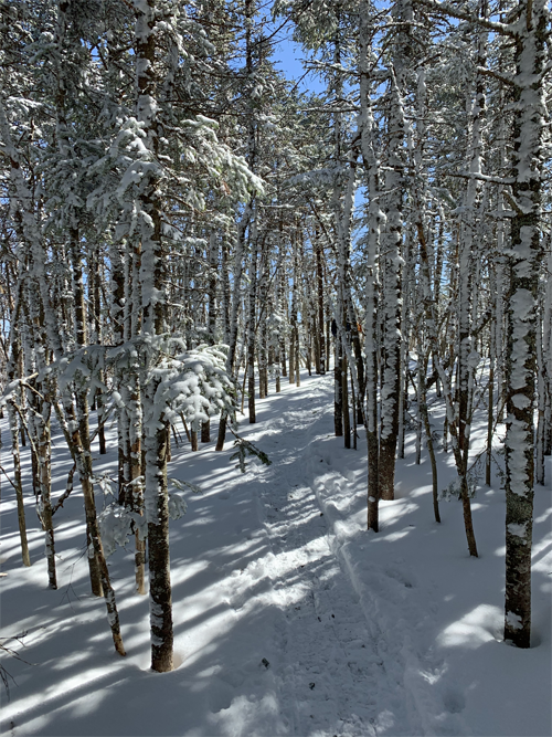
The monorail that was the path was crisp and hard, perfect for my new "trail crampons", but the countless post holes on either side of this 15" track provided ample evidence of how quickly you could get into trouble if you strayed. Even snow-show-sized holes were often 18" deep, and some of the boot-sized holes didn't seem to have a bottom.
 Hancock from the loop junction. The path descends a little into the bottom of the valley then goes straight up.
Despite the slow-poke being out front and the energizer bunny tagging along behind, somehow we set a blistering 2.5mph pace all the way up the valley, pausing only to admire the stunning winter views, or to savor the brook crossings made easy by the substantial ice bridges. Conditions were just that perfect.
 The view from the Hancock lookout. Nothing like as grand as Osceola, but better than still to come South Hancock which had no view at all.
Still feeling bullish we turned up the mountain. And slowed quickly. Soon we were in the old routine of grinding up 50-70 feet then stopping to suck in double-lungfuls of air until heart-beat and breathing returned to something resembling normal. But fitness isn't just about whether or not you run out of air, it's about how quickly you can recover from it when you do. I was amazed how quickly we could bring the breathing under control and set off for another stretch. I wasn't counting but I suppose this cycle continued for about three-quarters of an hour until just as suddenly as it had started the slope eased up and we were on top.
 The saddle between Hancock and South Hancock, and how quickly you can get into trouble if you step foot off the trail.
We took the short path down from the summit to the lookout, and unpacked the fatboys and the usual cheese, salami, bread, tomato, and chocolate lunch. For the first time the cold cuts were pre-sliced, but we'll definitely be doing that again. We agreed to save the beer for the second summit. T-shirts and fatboys were enough to keep the cold at bay, but after packing up we neither of us wanted to take the fatboys off, so as we had on the Osceolas, we set off for the second peak and home still wearing them. The saddle was easy, the train picking its way through a stand of spindly young pines and a couple of outcrops and then did a strange thing: splitting on either side of a leaning tree. To the left was a route that avoided ducking under the overhanging tree, which made sense, but the main path seemed to be the one that ducked under the tree. We took it and as soon as we'd passed under it realized we'd made a mistake. A few tracks cut back across to the main path, but otherside there was just a single set of snowshoe tracks. I took one step towards the main path and disappeared up to my thigh. I put the other foot down to brace and steady myself and dropped another foot. We agreed that Ryan should stay where he was while I tried to extracate myself unaided. Thankfully it was pretty easy. I lay back on my pack to spread the load then pulled my legs up as I rolled over back onto the trail.
That answered the question of how deep the snow really was. With the temperature climbing as the day advanced, in these sunny spots the whole trail was now getting noticeably more spongy. It was almost a relief to get back into the trees and firmer ground. The wind had also picked up sharply as soon as we crested Hancock, so by the time we reached South Hancock, that and the lack of view we quickly agreed to postpone the celebration beer. Ten seconds later we were at the top of the half mile descent back to the start of the loop.
Now old hands at glissades, we immediately got down on our butts and started down the luge. It was pretty much one continuous run. It wasn't long before I was overtaken by my map which took the corners like a pro and I must have followed it at least a hundred yards before it was so far in front I lost sight of it. I never saw it again. We came to a bend without much of a lip to it and my guess is that it overshot the trail at that point and was off to blaze its own way. Several parties on the way up scrambled to get out of the path before we plowed through them but they were all very encouraging and good humored. By the time we got to our feet we were only a couple of hundred yards from the junction. NOW we were ready for the beer.
 As has become the tradition I pack in the lunch and Ryan packs in the beer. Two more peaks done and dusted.
Pretty and easy it may have been, but four miles is a good long slog back out. But views like this were still worth stopping to savor. Still keeping up a good pace, we gained on a couple of guys also making for the exit. One was keeping up a continuous monolog. I missed the silence. We stopped to admire the view, take a picture, and create enough of a gap that we didn't catch up with them again until we reached the road. They were parked right behind us, and made up for their previous lack of etiquette by insisting on us sharing a beer with them. Most civilized.
Back to the Bear Mountain Burger in Lincoln. More determined to eat this time, we were disappointed to realise that they still did not have any outside seating, and we were not ready to compromise on that. Having established that they could provide beer in a take-out order, we settled for that. One step closer to a return to normal.