Kilimanjaro: Maps
Maps, Satellites and Google Earth
Maps
| Night stop: | BOS-AMS |
| Elevation: | - |
| Gain: | - |
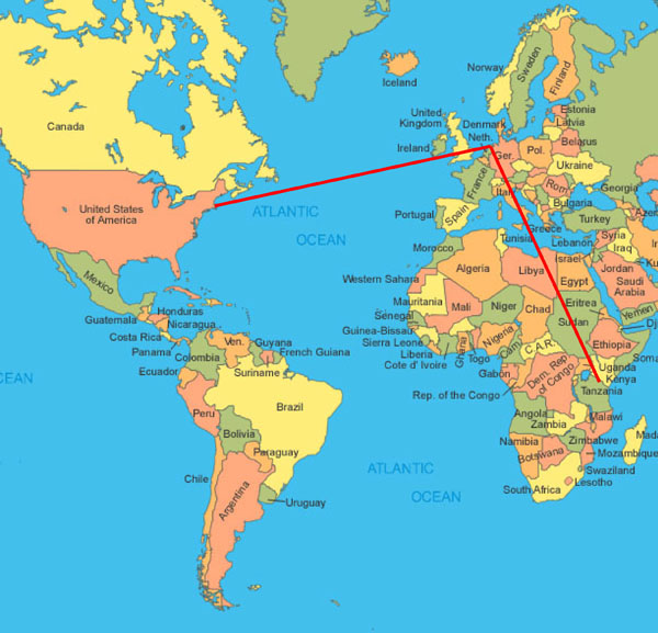
So what do you need to know? After some folks started asking me if Kili was in the Himalayas, I put this travel slide on the front of my presentations:

I like it because it is all close enough to the equator that Mercantor distortion is not a problem. So you can see that the flight to Europe is slightly shorter than the flight to Tanzania.
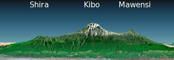
The next slide in the presentation then orients the mountain:

This excellent shot shows the profile of the route. We started on the far left (north western) side, and walked through the rain forest to the Shira plateau rim, that first clear summit right under the word Shira. Then we spent two days, three nights, crossing the Shira plateau until we ended up at Lava tower, right at the foot of Kibo.
We then spent two days walking around Kibo, at about the snow line in the picture, until we were pretty much between Kibo and Mawensi. From there the final asent is one day march to the top.
The final two days brought us straight down the mountain ending up in the lighter green band at the bottom, probably somewhere pretty much directly under the "M" of Mawensi.
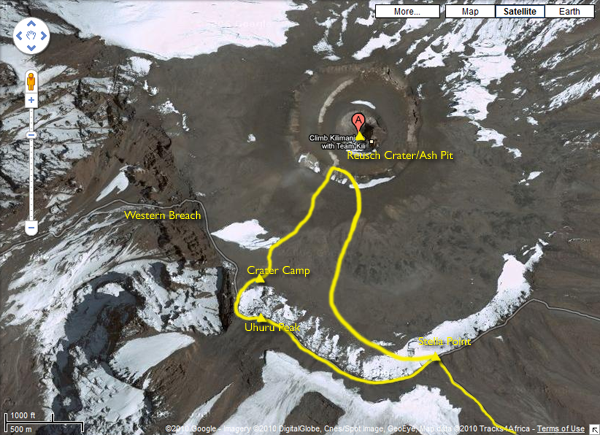
This next map plots the route from above. The beginning and the end seem pretty accurate. But across the Shira plateau I think it comes adrift. For starters, we took a detour after Shira 1 (clearly marked as the second camp on the route) and went back to the Shira ridge, which is definitely not marked here. I'm then sceptical that Shira 2 is that close the ridge. I think instead it might be the camp marked to the north east, which the indicated path bypasses. The Lava Tower, Karanga, and Barafu all all probably correct.

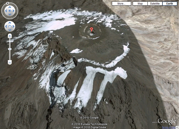
I stole the next couple of shots from Google. I love the fact that you can make out the glaciers just as they appear in our on shots from the ground. Also it is the bast possible way to get a perspective on the Ash Pit detour.

And finally here's pretty much the same view, but using Google Earth to get a little more prespective.

En Route. Please check your flight itinerary for flight details and departure time.