| Prologue | Wk 1: CA Hills to AZ Desert | Wk 2: High Desert to TX | Wk 3: TX Hill Country | Wk 4: Flowers and trees to LA | Wk 5: Mississippi to the Gulf | Wk 6: Florida Panhandle to the Ocean | Epilogue |
Steve Jobs: "A personal computer is a bicycle for the mind."
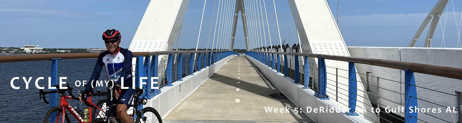
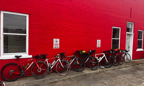
Week 5: DeRidder LA to Gulf Shores AL 482 Miles. 12,000ft elevation. 2449 Total Miles
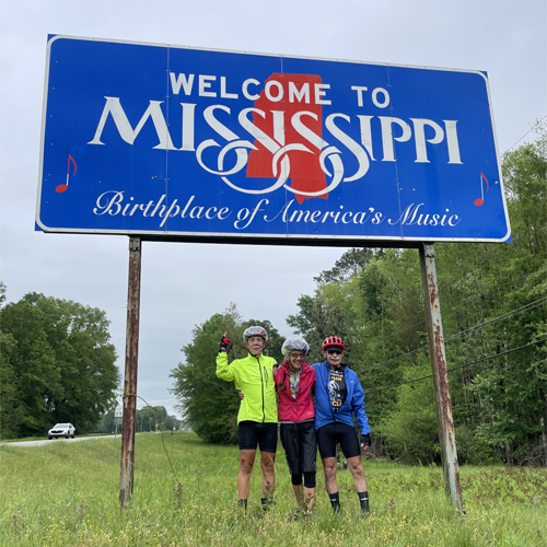
After spending three weeks in one state, (Texas), this week features three states in one week (Louisiana, Mississippi, Alabama). Other than Four Corners, is there anywhere in the US where you can hit so many states in so few miles?
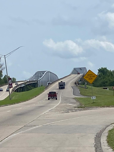
I love bridges, or at least the bridges that are proud to be bridges. Bridges on highways that are disguised as just another stretch of road or ugly utilitarian railway bridges don't count. A real bridge has to set out from some place of safety across a gap that would clearly be a thousand times harder to traverse without it, land you gently on the other side, and look beautiful doing it. To my great disappointment, the Colorado and Rio Grande bridges were both in the "just another stretch of road" category. The Pecos and Mississippi bridges are much more like it, but I've just realized that all my favorite bridges have one thing in common: they are all accessible to non-motorized traffic. Climbing to the top of the Sydney Harbor Bridge, strolling along the boardwalk high above the Brooklyn Bridge traffic, sitting with your honey in the middle of Paris's Pont Neuf, all fill me with gratitude for the efficiency, awe for the engineering, and admiration for the art.
On a trip like this many of the bridges did represent important milestones. You are either east or west of the Colorado, Rio Grande, Pecos, or Mississippi. I guess you can be north or south of the Rio Grande too, though that puts you into a whole different category that we had no intention to explore. But let's face it: much as I looked forward to each and every one of them, most bridges suck and a significant number of them are downright dangerous. Windy, high, narrow, badly maintained, several were so bad that the sag wagon had to provide cover so we could take up the whole lane. The first of those is coming right up.
Tuesday April 4 De Ridder LA to Ville Platte LA Elevation: 203ft
Temp: 73f - 82f Ascent: 1230 ft Distance: 78 Miles
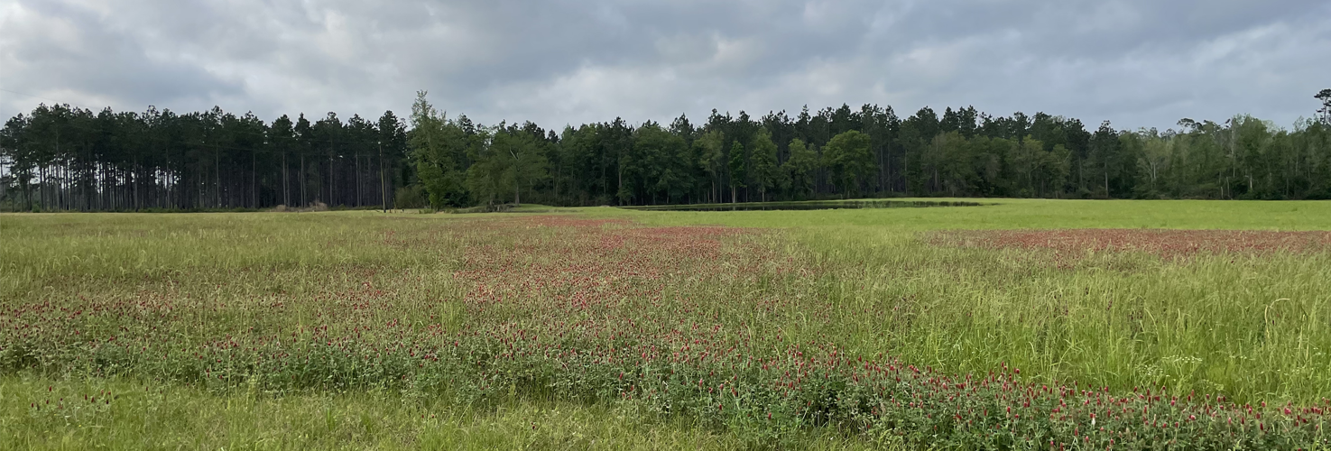
Betsy's blog does a wonderful job describing today's ride, so I'll hand over to her. "We started our journey across Louisiana in earnest today. We covered 78 miles and 855 ft of elevation, which translates to more pancake-flat roads. The Louisiana countryside is not as littered with wildflowers as Texas, but the wetlands we passed through featured the most beautiful shades of green. We passed swamps, lush wetland grasses, flooded fields with crawfish traps, and bright green rice paddies.
I often alternate riding groups, and that’s what I did today. I started the day riding with the B group (B for beautiful) and riding after lunch with the big dogs who cycle at a faster pace. There were eight squashed armadillos along the way—Here she speculates about them following global warming trends—migrating east toward Georgia and the Carolinas, no doubt. However, the most impressive roadkill today was a large variety of reptiles and amphibians—15 crushed turtles, 12 deflated snakes, and 1 eviscerated bullfrog.
So, to my profound relief I was in much better shape this morning. By no means back to normal, but at least capable of getting on the bike. The alternative was unthinkable. My rough day yesterday has put a new perspective on things. I even stopped worrying about the rain, which held off all day. I was extremely relieved to find that though the ankle started to play up by lunch, by icing and medicating again over lunch, I was able to complete the day feeling no worse than when I started. I only need to keep that going, but there are several tougher days ahead, once we cross the Mississippi.
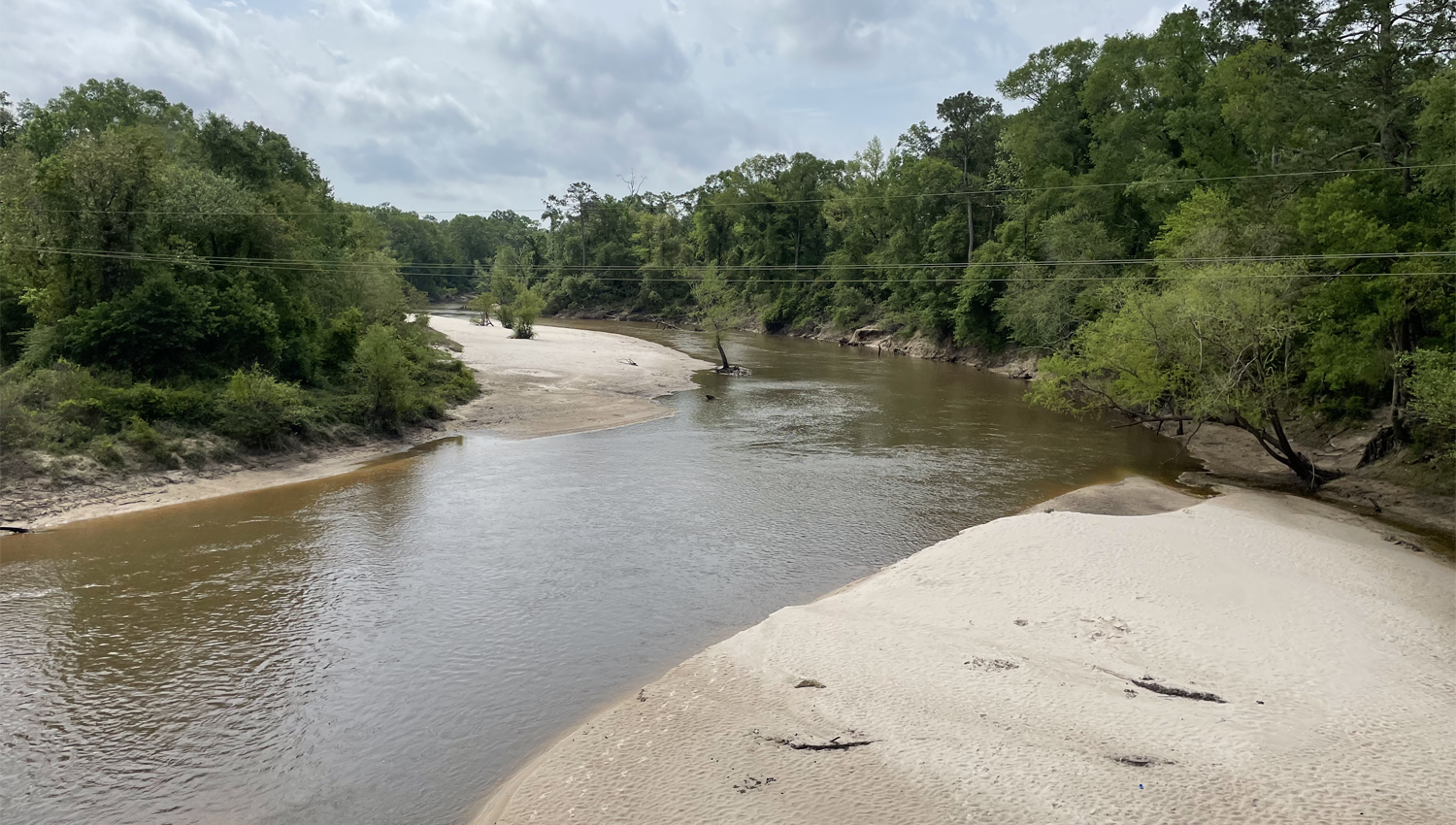
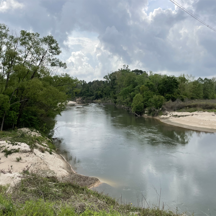
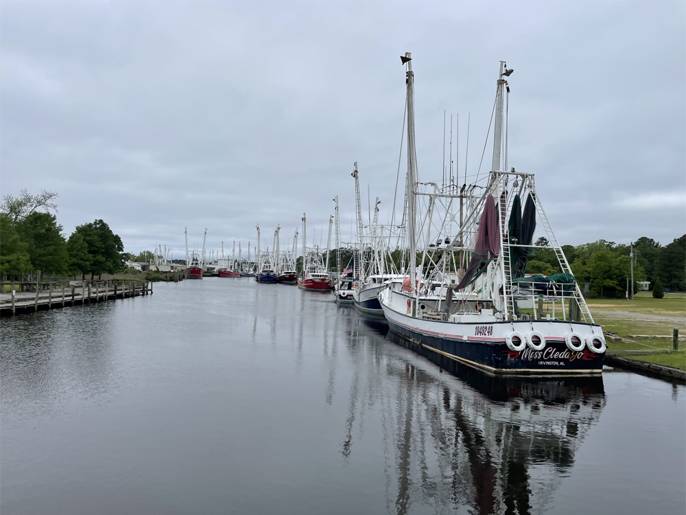
Calcasieu River
Rice paddies and crawfish ponds.
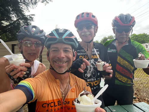
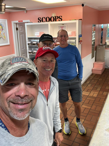
Bobby's cycling skills were legendary. He would hang at the back where he was supposed to be, then sprint on ahead fast enough to catch the leaders, then circle back to coast along with the caboose again. Oh, and meanwhile he was taking video of everyone as he went passed, or he let them come passed. So no surprise then that as he was tailing the B-Team into Ville Platte he managed to simultaneously use his phone to locate the only ice-cream store in town, and lead us half a mile off route to the target: Frosty Inn.
I'm not certain where we ate dinner, but I know we ate Mexican, and there is a Mexican right next to the Best Western where we were staying. So let's just assume we ate at El Charro, and that we ate typical Mexican fare because I certainly would not have eaten the steak options in a Mexican Restaurant, and because if there had been anything out of the ordinary, I would surely have noted it.
Wednesday April 5 Ville Platte LA to St Francisville LA Elevation: 148ft
Temp: 75f - 87f Ascent: 1345 ft Distance: 80 Miles
This was another Dog Day Morning. As usual, Dennis' detailed knowledge of the route meant that he knew that dogs were coming, but still, it was crazy. At one crossroad there were multiple dogs patrolling their yards on all four corners. Another time a passing driver stopped and got out of his van and helped distract the loose dogs so that we could make our escape.
Overnight Betsy did me the honor of placing Scout in my care once more. I think she thought I needed the moral support as I struggled with my Achilles heel. It was most touching and deserved a Changing Of The Guard snapshot.
There were also polecats. I learned that polecat is the local name for skunks. This is a bit odd because polecats are their own thing, which is not a skunk. It is a type of ferret. It's like saying the local name for lion is tiger.
At about the 39 mile mark we pulled in at Krotz Springs for a re-group. What a busy little spot it was. Kevin got his nth flat so close to the target that he pushed his bike to the parking lot, where he and Bobby wrestled with his tire. Dave wanted to buy a new T-shirt for his buddy from an earlier trip, who had lost the one they bought from this same store within hours of its purchase. Then Bobby chatted with an active duty soldier who climbed down from the cab of his army truck and instantly recognized Bobby and his military-grade baseball cap as the real deal and came over to chat with him. Nice. It was hot, and the rest of us huddled for shade on the porch of Kartchiner's Grocery.
|
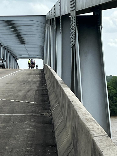
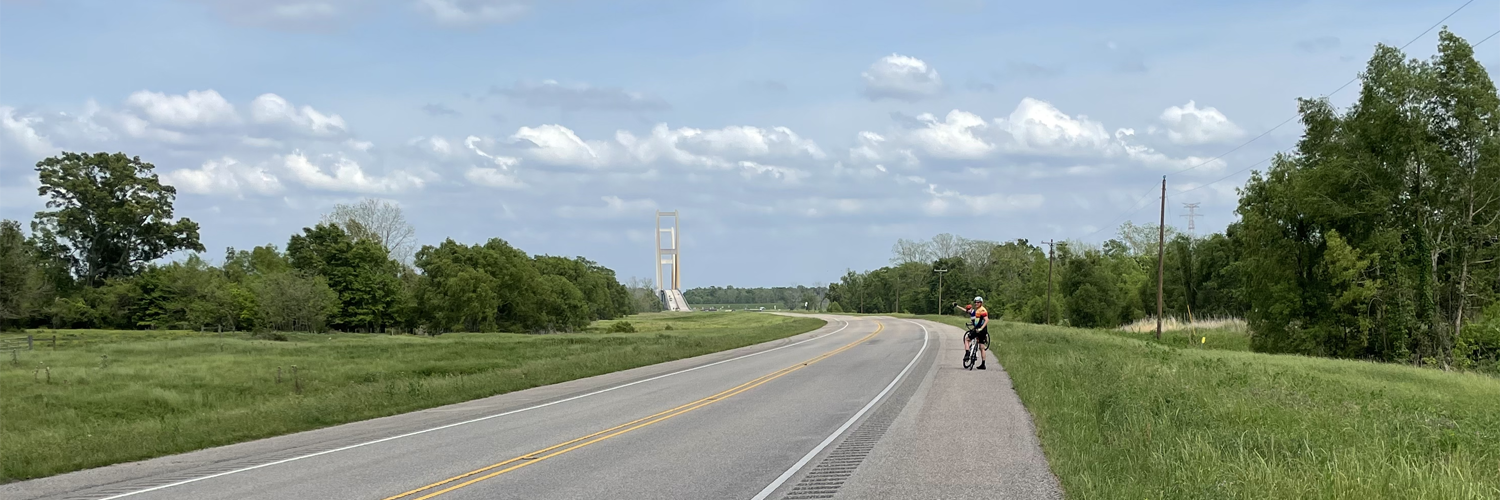
The bridge over the Atchafalaya River loomed large, but the 6-mile viaduct just beyond it was a much more serious challenge. Dave-the-Elder who had stormed this stretch on his previous trip was not looking forward to it. But Dennis had a plan. So to Dennis' plan. We would cross the Atchafalaya Bridge and regroup about a mile further east, where hard shoulder disappeared completely as the road narrowed onto the viaduct over the Sherburne Wildlife Management Area. From there, Bill would lead a peloton across the viaduct at a steady 14.2mph. We would take up the whole lane with the van and trailer right on our collective ass providing cover. A brilliant and effective plan, not least in the choice of leader cementing Bill's new position as a bone fide member of the team. I swear I could see his sense of pride as he lead us out into the traffic. Dave's trepidation was well-founded. The average drop to the swamps below must have been about thirty feet, and the concrete balustrade was exactly the right height to simply flip you over the edge if you were careless enough to argue with it. But with the van and trailer running interference we were free to ride two or three abreast and (almost) enjoy the safety and the views. Soon after that was lunch, and the option to take a 20 mile detour to bag a century. Obviously I was having no part of that. Dave and Shelley my now constant companions, were just as obviously game, but had misgivings about leaving me alone. I reassured them that they ab-so-lutely needed to do the extra loop if that was their heart's desire, and all was cemented when it became clear that Kevin also declined and was happy to ride with me. Normally it would not be a big deal either way, but Dennis and Bobby were anxious that for this stretch we all had backup, because the split would stretch the support crew to the limits. The century folks peeled off left and would meet back up shortly before the Mississippi Bridge. |
Atchafalaya bridge ...
|
... not bad as bridges go: not too narrow, not too high
|
|
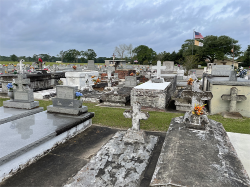
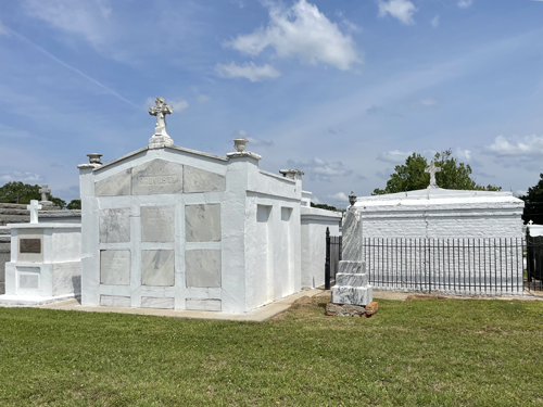
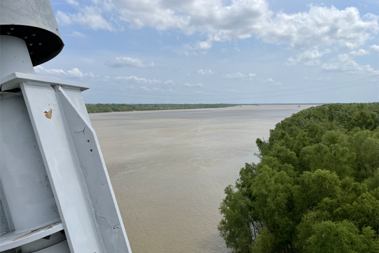
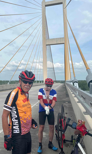
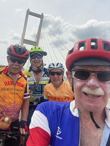
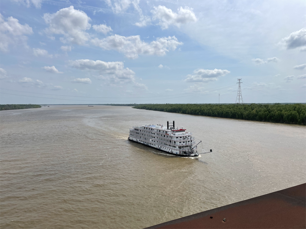
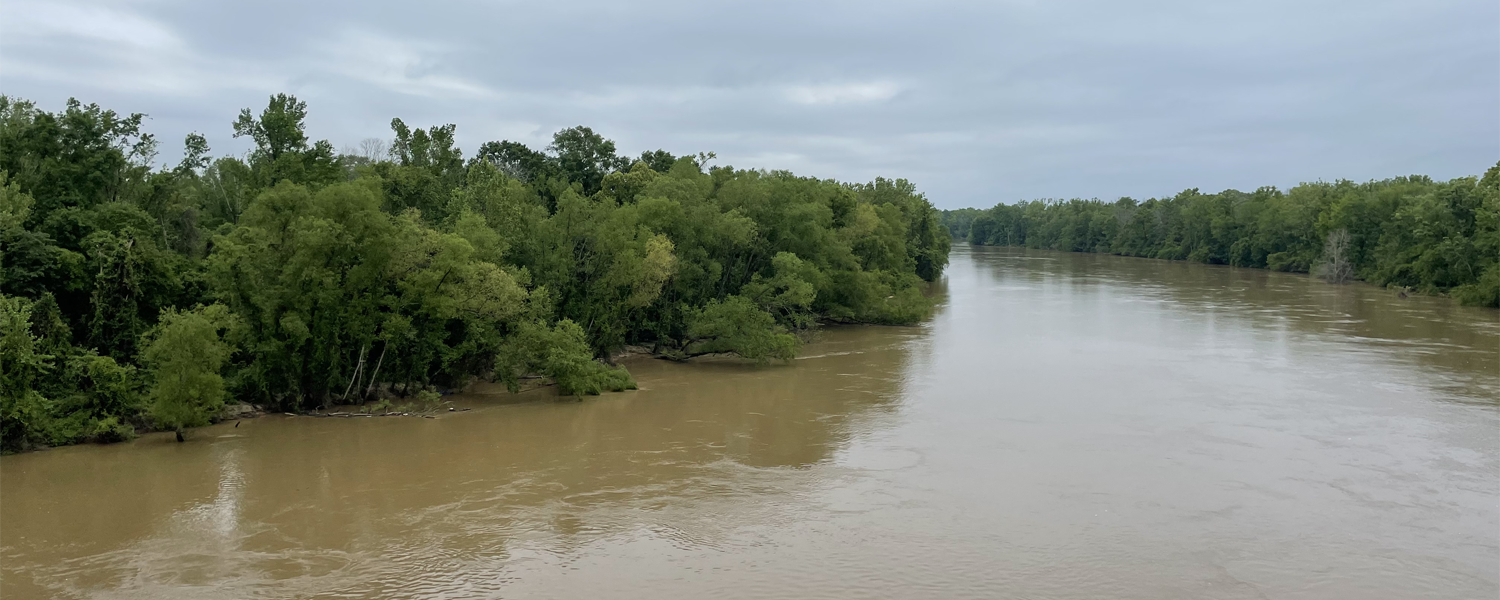
The rest of us pressed on and soon were confronted by a wide body of water: clearly the Mississippi. Or so we thought. I found a place with a good view and pulled over to take a snapshot of this momentous occasion. I'm so glad I picked it. Right there was an information board describing the appropriately named False River, an oxbow lake that of course before being cut off would have been a section of the Mississippi which currently was following a course that was still about five miles away. As we close in on the Mississippi the water table is rising and as a consequence so are the vaults in the cemeteries. The whole route seems well-manicured now, with immaculate lawns as weed-free and closely cropped as a golf green and even the road verges are neat and tidy. At about the 70 mile mark and soon after rejoining the victorious extra-pointers we finally reached the bridge. As we set off from a photo op right on the apex of the bridge Dave-the-Elder got a flat. Shelley and Kevin had already set off and there was no turning back, and the sag wagon couldn't do more than wave helplessly as it went by, so Dave and I were on our own until Stephen showed up. It took all three of us: Dave had most of the tools and the new tube; I had the muscle to wrestle the tire back on; and after a CO2 failure Stephen magically produced an old-fashioned brass hand pump which made short work of putting some pressure into the tube. I even had the time to wait for the steamboat to get close enough for a decent shot. |
Up come the vaults ...
|
... New Orleans style
|
Dave reminds me in which direction St Augustine lies: across the Mississippi bridge. He's nearly hidden by Kevin who is having a slow day, slumming it with me while the rest of the big dogs and the rest of the B-Team took the Century option.
|
|
|
|
I'm totally fixated on the issues for each day, forgetting yesterday, not thinking about tomorrow. Managed to get here today because it was flat, and the promised rain never arrived. The wind remains a relentless enemy. It was in our favor for the last ten or twenty miles but again this is just random, not something to look forward to. It has been at every point of the compass that does NOT mean from the west. If it is in our favor it is because we happen to be going northish, and the wind is from the south to south east, or we are going southish and the wind is from the north to north east. But my ankle is clearly swollen, and is sore both at lunch time and at the end of the day. The 80 mile days are relentless this week so there are no breaks.
RT trying to be cool. Scout trying to breath inside his zip-lock rain jacket
It was hot but we did a good job staying hydrated, and my new regime of collecting ice on my way into the room gives me what I need to ice my tendon, fill my 32 oz. Ruby's plastic bucket with ice water to be drunk before going out to supper, and a few cubes left for a G&T when we return.
Speaking of supper The Francis Southern Table and Bar was another restaurant I would be very happy to visit again. The chargrilled oysters were best of show, so big that it took a dinner plate to serve up six of them. But my "gulf shrimp and Louisiana crawfish in a Romano cream sauce with andouille sausage over linguine served with a house salad" was beyond delicious also. Speaking of the salads ...
Dave-the-Younger: "Pepper jelly vinaigrette? What is that?"
Waitress: "It's delicious!"
D-t-Y: "I'll take it!"
I laughed out loud. First of all in no way did the waitress answer the question, and second D-t-Y was not known for being particularly adventurous. Obviously I chose it too. D-t-Y "You'll try anything new won't you?" RT: "Does the Pope poop in the forest?"
Thursday April 6 St Francisville LA to Amite (Franklinton) LA Elevation: 115ftTemp: 72f - 73f Ascent: 3766 ft Distance: 88 Miles
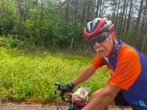
Doug and RT find a little shade
|
Today is another day. 88 miles this time, way more climbing, and way greater chance of rain. Once again a bunch of reasons not to be able to make it. But like I said, one day at a time. Dave-the-Elder, RT, Shelley: Surprise!
|
Amite River
|
|
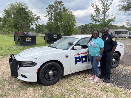
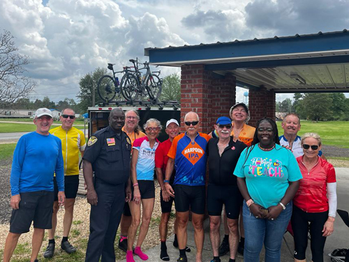
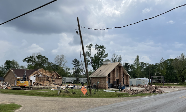
We were lunching under the awning of Brown's Chapel Missionary Baptist Church in Tangipahoa when a Police cruiser pulled up. Chief of Police Darrell Martin stepped out, introduced himself and his passenger, the Lady Mayor, and then ever so politely enquired about our business. Having ascertained our innocent purpose, Chief Martin declared that he was also a Deacon of the church, so he opened it up so we could use the bathrooms and the AC which was blasting away in the empty church. Not what I was expecting. He and the mayor then regaled us with stories of the tornado that hit the town six weeks before, obliterating three mobile homes the space for which we could see from where we sat, and demolishing the Quinn Chapel AME Church which we passed shortly after lunch. Mercifully nobody was killed but even all these weeks later, the visceral effect of seeing such devastation with our own eyes instead of through the anonymizing and numbing filter of a TV screen was sobering to say the least. You may have noticed that I have stopped bitching about Billy-Bob. I do not know if someone said something to him or not, but over the last couple of days he has consistently been ready to leave when he is supposed to and it has made a massive difference to me and I suspect to others too. He's also less distracted on the road, so stops less frequently, which all adds up to a much tighter team. I congratulated/thanked him as I drafted passed him on one stretch. |
Chief Martin and the Lady Mayor
|
L to R: Dennis; Kevin; Chief Martin; Bill; Shelley; Doug; RT D-t-E; Steven; Lady Mayor; D-t-Y; Betsy
|
The accommodation choices in Franklinton were limited to a single motel with standards that had slipped to a point that Dennis could no longer tolerate it. That was a big decision to make because that made it the only town on the whole route where we had to be bussed out. The backup, Amite, was great, but a huge hassle for all the bikes to be loaded up, everyone bussed the 30 miles or so, and then reverse the whole process in the morning. Franklinton must have been really bad, but yet another class decision from Dennis. It also gave us the opportunity to visit The Boston. Another great restaurant, and another cute waitress. Life is good. I really liked the local Gnarly Barley Jucifer IPA and the logo'd glass, and the waitress sneaked me one as a souvenir. (Bonus: it is currently also one of the options in the happy hour cooler.) At Dennis's recommendation I think about half of us had the Crunchy Wasabi Tuna: yellowfin tuna steak seared to your liking with a wasabi pea crust and finished in wasabi aioli, ponzu, and a sweet soy reduction. Oh yes.
It was time to pass Scout on again, and I had no hesitation in presenting him to Bill, as the award for "Most Improved Team Player."
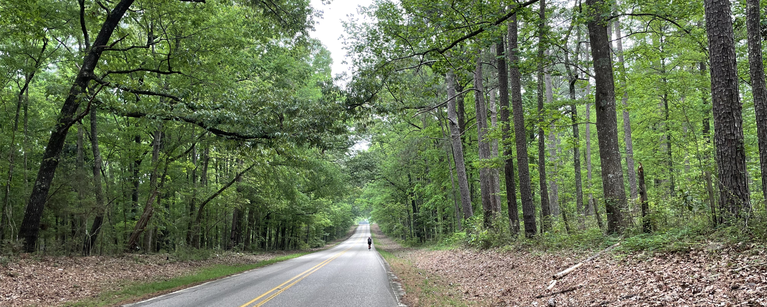
Friday April 7 Amite (Franklinton) LA to Wiggins MS Elevation: 262ftTemp: 62f - 73f Ascent: 2969 ft Distance: 84 MilesSo a weird start because we had to be shipped back to the Franklinton starting line. Although it had clearly rained steadily overnight by some miracle we had wet roads all morning but no actual wet. There is a (large) Baptist church every few miles. I can’t figure out a) why we see twenty churches for every school we see, b) why their graveyards are so small (never more than an acre) especially as the churches themselves could easily hold a 2-500-strong congregation. |
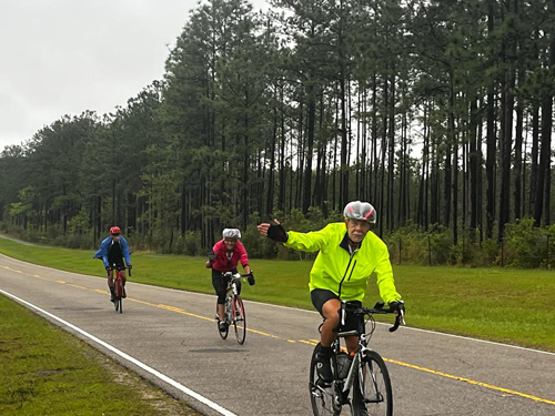
I present to you: the B Team!
|
The Southern Baptist ConventionMost early Baptists in the British colonies came from England in the 17th century after conflict with the Church of England for their dissenting religious views. In 1638, Roger Williams founded the first Baptist church in British America at the Providence Plantations, the first permanent European American settlement also founded by Williams in Rhode Island. By 1740, about eight Baptist churches existed in the colonies of Virginia, North Carolina, and South Carolina, with an estimated 300 to 400 members. New members, both black and white, were converted chiefly by Baptist preachers who traveled throughout the South during the 18th and 19th centuries. The southern pastors interpreted the Bible as supporting slavery and encouraged paternalistic practices by slaveholders. They preached to slaves to accept their places and obey their masters, and welcomed slaves and free blacks as members, though whites controlled the churches' leadership, and seating was usually segregated. From the early 19th century, many Baptist preachers in the South also argued in favor of preserving the right of ministers to be slaveholders. The issues surrounding slavery dominated the 19th century in the United States. This created tension between Baptists in northern and southern states. In the two decades after the American Revolution, northern Baptist preachers (as well as the Quakers and Methodists) increasingly argued that slaves be freed. This difference came to a head in 1845 when representatives of the northern states refused to appoint missionaries whose families owned slaves. To continue in the work of missions, the southern Baptists separated and created the Southern Baptist Convention. The Southern Baptist Convention (SBC), alternatively the Great Commission Baptists (GCB), is the world's largest Baptist denomination, and the largest Protestant and second-largest Christian denomination in the United States. Organized in 1845, the denomination advocated slavery and during the 19th and most of the 20th century, it played a central role in Southern racial attitudes, supporting racial segregation and the Confederacy while opposing interracial marriage. In 1995, the organization apologized for its history. |
|
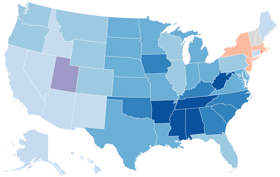
Religious denomination by state The map shows the largest religious denomination by state as of 2014. In 48 out of the 50 states, a Christian Denomination was the largest religious group. |
This seems to immediately answer the first question: how come there seemed to be so many of them? Answer: because there were. I live in one of the only states in the US where Catholicism is the most popular choice, and even then it only covers half the population. Compare and contrast to Mississippi where Protestantism (read Baptists) is more than 70% and even Louisiana is more than 50%. But it raises another: why did/do black baptists tolerate this prejudice. And the answer to that, of course, is that they did not, and do not. It is/was my ignorance that assumed that the "Southern Baptists" moniker applied to all baptists, whereas in fact the vast majority of Southern Baptists are white (85%), with few black members (6%) and even fewer Latinos (3%), according to the 2014 Religious Landscape Study. Meanwhile almost exactly half of all Baptists are black. So where are all the others? Southern whites generally required black churches to have white ministers and trustees. In churches with mixed congregations, seating was segregated, with blacks often in a balcony. White preaching often emphasized Biblical stipulations that slaves should accept their places and try to behave well toward their masters. After the Civil War, most freedmen set up independent black congregations, regional associations, and state and national conventions, independent of white supervision. They quickly left white-dominated churches and associations and set up separate state Baptist conventions. In 1866, black Baptists of the South and West combined to form the Consolidated American Baptist Convention. In 1895, they merged three national conventions to create the National Baptist Convention. With more than eight million members, it is today the largest African American religious organization and second in size to the Southern Baptists. As late as the 1960's civil rights movement, most Southern Baptist pastors and members of their congregations rejected racial integration, opposed interracial marriage and accepted white supremacy, further alienating African Americans. Finally in 1995, the convention voted to adopt a resolution in which it renounced its racist roots and apologized for its past defense of slavery, segregation, and white supremacy. This marked the denomination's first formal acknowledgment that racism had played a profound role in both its early and modern history. |
 Attribution:
 |
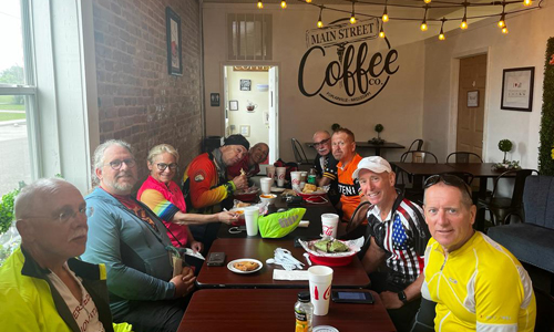
We had lunch at the Main Street Coffee, (unusual, we generally picnic) and the radio was tuned to a religious station which educated us about Easter between tunes. Perhaps the channel was only selected because it was Good Friday but somehow that seems unlikely. Nor the fact that here and elsewhere folks were wearing "Jesus loves me / us all" type T-shirts. I tried to order a "soup and salad" combo, which they said they'd be happy to do. Sure. That's because they gave me full-blown portions of red pepper soup and chicken salad. Much mirth at the table for the size of my order. I waddled out of the cafe, and we chased home trying to beat the "4:15p rain start". |
Did somebody say "lunch"?
|
L to R: RT; Bill; Betsy; Steven; Shelley; D-t-E, D-t-Y; Doug; Kevin
|
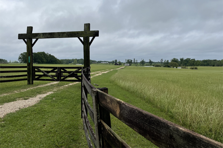
The epitome of a Louisiana ranch?
|
At the 27 mile mark we crossed the next big river, the Pearl, separating Louisiana from Mississippi. Yes, that was a surprise to me too. In the north of the state Louisiana and Mississippi are separated more appropriately by the Mississippi. But then about half way south the Gulf, the border suddenly heads due east about 150 miles until it hits the Pearl, and uses that to make its way to the Gulf just east of New Orleans. (The Mississippi hits New Orleans from the west.)
|
The usual suspects: RT; Shelley; Dave-the-Elder
|
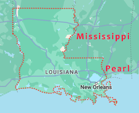
Pearl River, Louisiana border with Mississippi
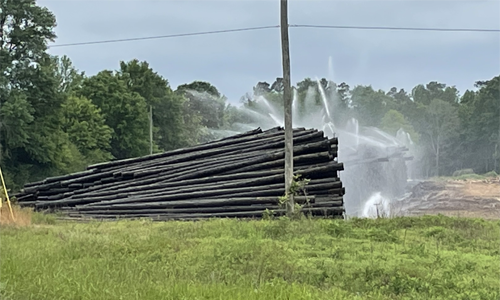
Soon after lunch in the aptly named Poplarville which was full of lumber yards we passed this scene in one of the yards. I'm not sure why I find it so captivating, and more to the point, profoundly disturbing. Perhaps it is as simple as the scale of the pollution with that chemical-laden water draining to ... where? Worse, there seems to be something apocalyptic about it that I cannot put my finger on.
The B Team arrived home shortly before 3:45p but as I write this as 8:15p it is still not raining. The skies are getting blacker and blacker however. And thunder is rolling, which is Dennis's big no-no. So a great day of backroads, smooth pavement, shallow inclines, and no rain!
For once the food was decidedly mediocre, so the highlight was me misreading the menu and changing my beer order not once, but twice. I thought I was clear, and in a way I guess I was, because the waitress returned with all three beers. A Modelo, a Fat Tire, and my final choice, Goose Island IPA. I managed to sell the first two to my teammates. Dennis was buying as this was the first night in Mississippi, but that made it worse: I would not want even the appearance of taking advantage of his generosity. Selling the extras to other members of the crew helped to assuage that.
Saturday April 8 Wiggins MS to Moss Point MS Elevation: 16ft
Temp: 61f - 73f Ascent: 1667 ft Distance: 81 Miles
As I applied the Chamy Butter to my butt, the diclofenac sodium topical gel (highly recommended) to my heel, ChapStick for lips, and sunscreen to everywhere else, it occurred to me that I have never been so lubbed up. Never spent so much time preparing myself for the day.
A first at breakfast. Biscuits but no gravy. I mentioned this to the breakfast maven.
Maven: "No room!"
RT: "No room? So grits are more important than gravy?!"
Maven: "I guess so! I said the same thing and management said 'grits not gravy'"
RT: "Sheesh. I don't think I've ever seen that before"
Maven: "Would you like me to make you some? I could make you some!"
What a sweetheart.
We rode 81 miles on rain-soaked roads, which covered our bikes and the riders behind us in road splatter and mud. Bobby drove the van ahead of us, and one point, kept us at one rest stop a little longer than planned to allow a storm cell containing a torrent of rain to move past so we didn’t get dumped on.
In another sign of the more innocent minds that I attribute to the deeply religious, we passed the "Honey Hole" donut shop. I just can't imagine the dirtier minds of other parts of the country letting that go.
|
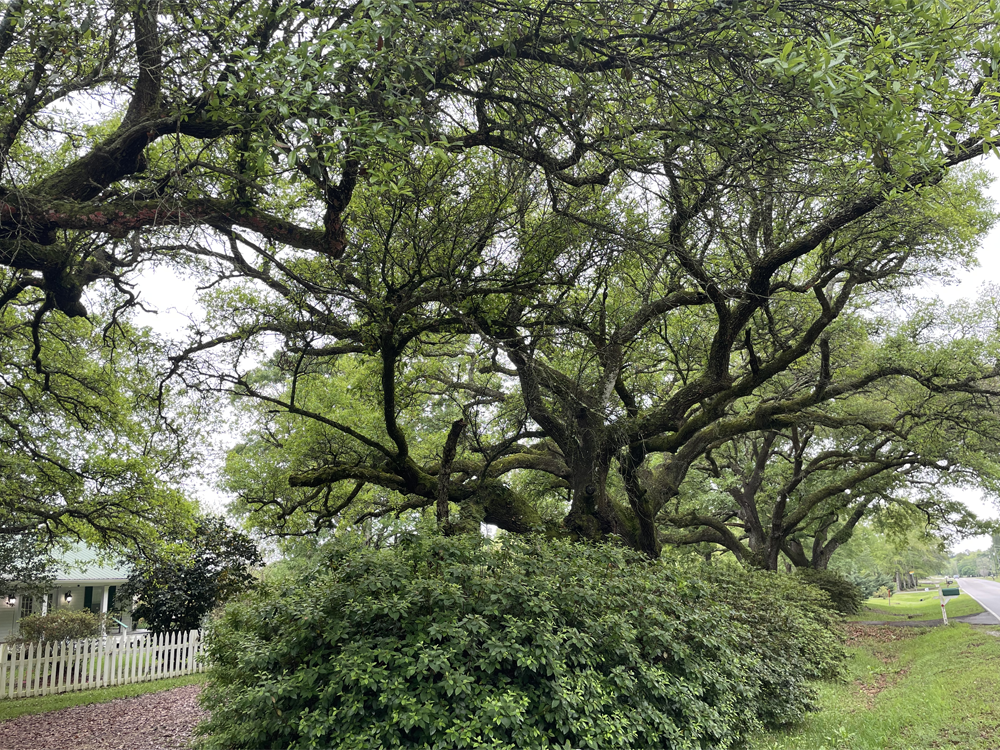
I never get tired of the live oaks
|
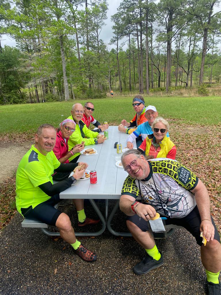
Sandhill Crane lunch stop: D-t-Y; Betsy; RT; Kevin; Steven; Doug; Betsy; Billy-Bob. One of my favorite group shots at one of my favorite lunch stops. Not sure what Bobby is doing in the background, and we will not ask.
|
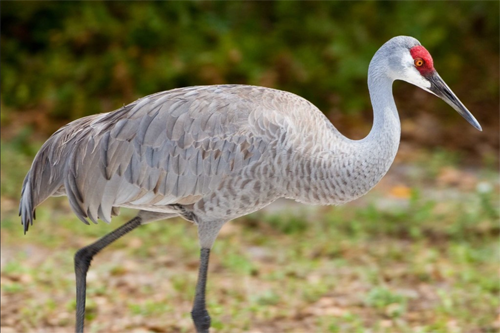
The Mississippi Sandhill Crane National Wildlife Refuge in Gautier, MS, was another inspired lunch venue that required a detour of a mile or so but was totally worth it, even though I did not fully grasp how great a privilege it was to stop here until I got home and read all the literature I picked up. I was even more pleased that I had taken up the warden on his offer to look through the spotting scope he had set up in the foyer to get a good look at a pair of cranes at a feeder that had been strategically placed on the edge of the "savannah" as these wetlands are called.
|
Mississippi Sandhill CranesThe Mississippi Sandhill Crane was one of the first species listed as "endangered" when the Endangered Species Act was enacted in 1973. The Mississippi Sandhill Crane National Wildlife Refuge was created to provide protection and management for the cranes, one of the rarest bird populations on earth. The refuge, in turn, became the first refuge to be authorized by the new law. As a result, restoration of this globally-rare habitat to protect and restore an endangered species began in 1975. To enhance natural production, a captive breeding and release program was begun. Starting in 1965, eggs from wild cranes were sent to the U.S. Fish and Wildlife Service's Patuxent Wildlife Research Center to form a captive breeding flock. Since 1981, offspring from this flock have been released annually on the refuge as part of the restocking effort. This crane supplementation, the longest and largest in the world to date, has resulted in a population increase to over 100 individuals and nearly 25 breeding pairs. The Mississippi Sandhill Cranes (4 - 4.5ft tall) are a separate sub-species that does not migrate unlike its smaller and larger cousins, the Lesser (3 - 3.5ft tall) and Greater Sandhills (4.5 - 5ft tall). They are also darker grey with a much brighter red head and white cheek patch. Sandhill cranes resemble great blue herons (Ardea herodias). A major distinguishing characteristic is that cranes are completely gray. Great blue herons usually have white on their heads and dark colored underparts. |
We finally got wet for the first time since we started. A five minute shower, 85F. No problem. Four straight 80+ mile days, and three straight when we should have been drenched but were not.
The ocean! Nearly. Not much easterly progress today, but it felt like a big step to get to the gulf. So the first gulls since San Diego. Once again we dodged several bullets rain-wise but we finally got wet for the first time since we started. A five minute shower, 85F. No problem especially since an inch of rain had been forecast. Four straight 80+ mile days, and three straight when we should have been drenched but were not.
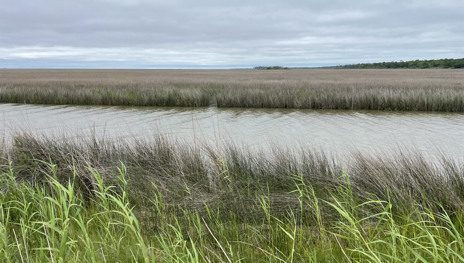
Escatawpa River Marsh Coastal Preserve.
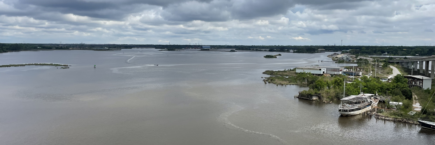
Ironically having headed south all morning to get to the gulf, the briefer after lunch ride took us north again complete with spectacular view of the Escatawpa River Marsh Coastal Preserve, part of the complicated and much larger Pascagoula River Marsh Coastal Preserve.
The third outstanding restaurant in a week, Brady's Steaks and Seafood was a short back the way we had come and right up my street. I had the special, grilled tripletail, because I'd never heard of it. It turns out to be a very popular fish both for anglers and for diners. It is considered by many to be equal or similar to a red snapper or grouper which apparently means it is one of the best-tasting fish, period. I would agree with the pundits that it is firm and white with flaky, particularly sweet meat. Yum.
Sunday April 9 Moss Point MS to Gulf Shores AL Elevation: 7ft
Temp: 51f - 61f Ascent: 968 ft Distance: 71 Miles
Another sweet breakfast maven. This time she wanted the team to say a prayer "for our health and safety." There was an awkward moment of silence until someone asked her to lead it, which she did without hesitation.
A very eventful day. As usual now, we woke to a stiff headwind, but this time it had a much more serious consequence: it could cancel the ferry across Mobile Bay. Almost as bad, it could allow the riders to brace the waves on the open deck, but not allow the high-sided van and trailer to travel. Both of these options would leave Dennis with the 100-200mile trip all the way around the bay, maybe with all of us inside, maybe not. We would not know the answer until we were well into the ride, depriving us of the pleasure of looking forward to it.
|
|
|
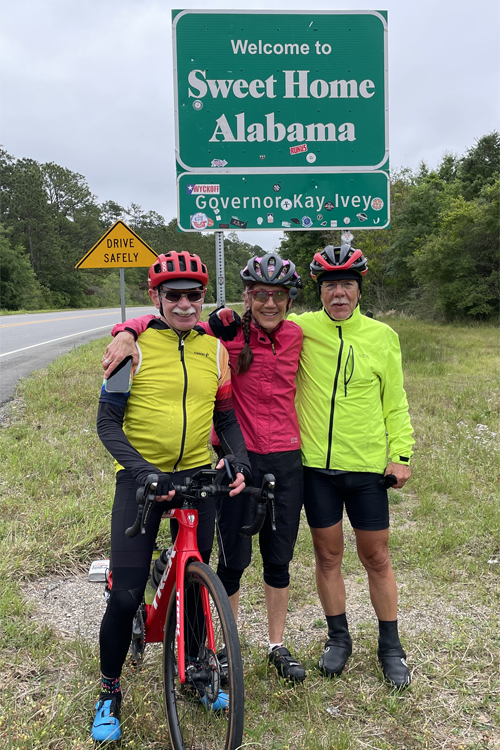
First things first. The 10 mile slog into the wind along grotty, fast, RT 90 to the Alabama border. The big dogs were dragging, so the B Team was still at the front of the pack when we stopped for the obligatory border portrait, and as luck would have it Bill pulled in just in time to capture the shot for us. Then over the only hill of the day and on through the much more lovely flats and marshes heralding the bay. I've always loved the distinctive broad stripes of color separating the water, the banks, the reeds, and their fluffy heads. They seem as carefully manicured as a botanical garden.
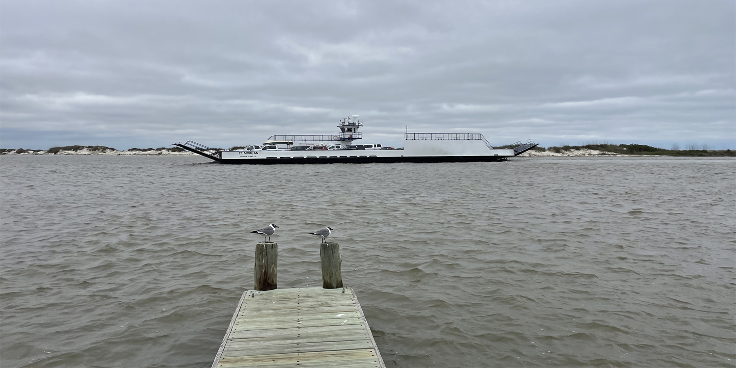
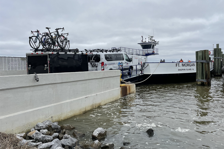
At around 30 miles we came to the T-junction with Rt 193, the coast road. Turn right to the ferry, turn left to go all the way around. Dennis was waiting at the junction with the news. Once again, the gods were smiling on us and we all turned right (I may take that back once I'm at sea).
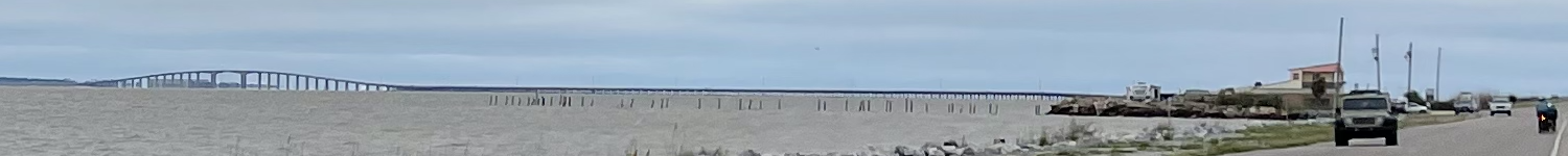
The Intercoastal Waterway and Bridge to Dauphin Island. At far right it looks like a bunch of victims making their final approach
|
The intercoastal waterway and Dauphin Island Bridge were about as much fun as some of us could stand. Narrow trashed-out shoulder, too good a view of the cold gray cold water too far below, and of course a nice buffeting cross-wind. Even the photographers amongst us were reluctant to stop. The obviously beach-holiday resort community on the other side was a calming contrast though with its deserted streets the empty cottages looked as if they were as miserably cold as we were. Just a few minutes we were in line for the ferry. We aimed to be first in line which we were, and we therefore aimed to be in plenty of time, which we were. But there was absolutely nothing else to do around the terminal, so some of us got back on our bikes and wandered down the street where we found Fort Gaines. We did not have time to take a tour which would have gotten us inside, but we had a good look around the outside where we discovered that the Brits had held the Fort in the early part of the 19th century—25 years after Independence. That made no sense, so the Fort immediately went on to the "further investigation required" list. |
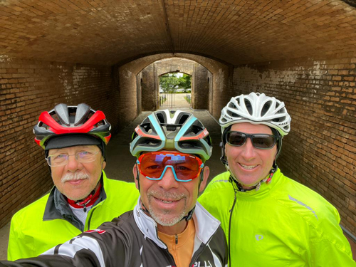
At the fort: RT; Bobby; Kevin
|
Fort Gaines
|
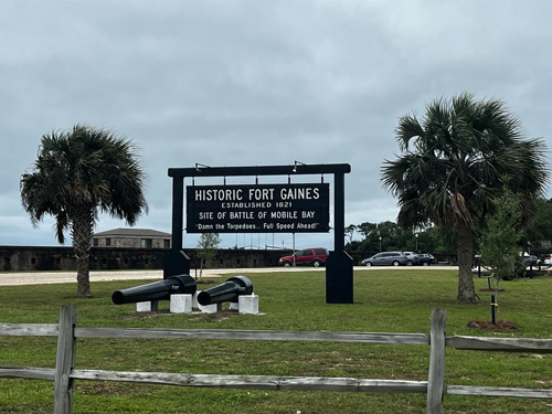
Fort GainesFort Gaines was a crucial site for the south during the civil war. The well-preserved ramparts of Fort Gaines have guarded the entrance to Mobile Bay for more than 150 years. Now a historic site, the Fort stands at the eastern tip of Dauphin Island where it commands panoramic views of the bay and the Gulf of Mexico. The Fort was recently designated as one of the Eleven Most Endangered Historic Sites in America due to on-going shoreline erosion. What brought Fort Gaines great success is being coupled with its brother, Fort Morgan, which is located on the opposite peninsula (and the ferry destination). This allows the Forts to control the main channel to the bay, keeping the land, ports, and supply ships safe from enemy fire. Fort Gaines was also crucial during the War of 1812 for helping the United States defend against the United Kingdom. The Forts are built in a star pattern, a classic defensive design in its day. Fort Gaines’ main objective was to give shallow draft vessels a sheltered anchorage. 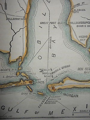
Dauphin Island and Mobile Bay were mapped as early as 1519 by Alonzo Pineda. But things did not really get going until 1699 when the French explorer Pierre Le Moyne de'Iberville decided to set up a colony here because of the abundant timber, reliable fresh water, and a great harbor, and despite renaming it "Massacre" because of the burial ground he discovered. Massacre Island soon became the headquarters for the French colonization along the Gulf Coast. It was renamed in 1707 in honor of the heir to the French throne: Dauphine. At this point the island was the capitol of the Louisiana Territory which was almost two thirds the size of the United States. During the course of the next century, control of Dauphin Island switched from France to Great Britain and to Spain in 1780. Finally in 1813 the United States seized the territory around Mobile Bay. The British captured Dauphin Island and used it as a base for a proposed campaign against the city of Mobile. The British took Fort Bowyer on Mobile Point before discovering that the War of 1812 had ended four months earlier. The War of 1812 proved that America needed adequate defenses for its long coast line. Construction of a fort as part of a comprehensive system of nation defence began in 1819, but was still not complete by 1861 when the outbreak of the Civil War left the remainder of the work to the Confederate State of America which added the last touches by 1862, just in time for its moment of glory, the pivotal role it played in the 1864 Battle of Mobile Bay, one of the war's most notable naval conflicts. The Battle of Mobile BayBy 1864 Mobile was one of the last ports open to blockade runners bringing supplies to the beleaguered Confederacy. In August Admiral David Farragut had assembled a large strike force to capture the forts that guarded the entrances to Mobile Bay. Farragut's fleet prepared to run the gauntlet in a daring manoeuver where four ironclad monitors would lead the assault on Mobile Bay as a screen beside fourteen wooden-hulled frigates lashed together in pairs. But the run between the two Forts Gaines and Morgan would demand a heavy price. At 6:30am on August 5 Farragut's fleet closed in. As his frigates ran the passage, the ships released volleys into the fort defenders, but the Confederate fire was more gruesome. "Shot after shot crushed into the Hartford," said one eye witness "mowing down men, deluging the decks with blood and scattering mangled fragments of humanity so thickly it was difficult to stand on the deck". Amid the carnage, hearing a muffled roar, Farragut turned in time to see the lead bottom and screw propeller of the U.S.S. Tecumseh turning in the air, sinking immediately. The torpedo (now known as a mine) field had claimed a victim. Farragut reacted immediately with his famous line: "Damn the torpedoes. Full speed ahead!" The Hartford, lashed to the Metacomet steamed through the heat of Morgan's withering fire to a safe harbor out of range. The Confederate Ironclad Tennessee, commanded by Admiral Franklin Buchanan, was left to fight one of the most lopsided contests in naval history with inevitable consequences. The Confederate sailors engaged as many as seven ships at once, firing into them from as close as three feet away. With the Tennessee's steering chains shot away, and her smoke stack so riddled with shot that the interior filled with smoke, the wounded Buchanan cruised to a point a mile north of Gaine's guns where at 10a he surrendered. Admiral Farragut could now turn his attention to Fort Gaines. The garrison was under siege from land and sea, day and night, until August 7 when a small boat bearing a truce flag was lowered from the Hartford and rowed to the Fort with a demand to surrender. The Confederates, sensing the hopelessness of any victory, accepted Farragut's invitation to visit the ship, and after discussing the placement of the forces against them, Colonel Anderson decided not to risk what would surely be a suicidal defence. The Fort surrendered on August 8th. Thus the Fort that took 40 years to build, and provisioned to withstand any attack from land or sea, at great strategic advantage, became an overnight victim of obsolescence. New armament technology doomed the Renaissance fort design. LaterThe fort served in World War I with a Coastal Artillery unit garrison manning the "disappearing" guns and became an anti-aircraft gunnery school during and following the war. World War II saw the fort used as a camp for the Alabama National Guard and a base for the U. S. Coast Guard stationed there to operate against enemy submarines prowling the gulf in search of merchant vessels. Today the Coast Guard still uses a base there to take part in crash rescue boat operations. |
|
|
|
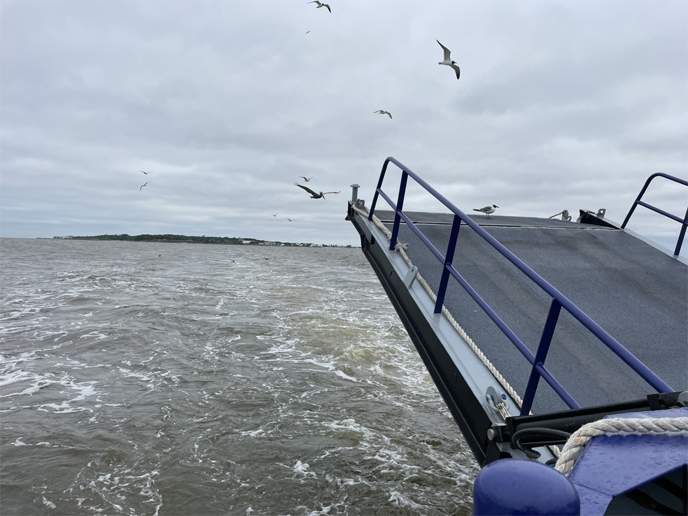
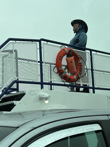
Back at the ferry terminal the pontoon-like roll-on roll-off ferry finally docked and let off its west-bound cargo, and on we went. Van at the front, bikes on the side, and ten or fifteen other vehicles squeezed in between. As soon as we set off for the Gulf Shore (and Fort Morgan) side, the already chilly conditions got markedly worse and most people bundled into the van. Not me of course, I needed to keep my feet on the deck and my eyes on the horizon. But it was a spectacular ride. Pelicans and cormorants dive bombed for fish and floated along in the breeze behind the ferry keeping exactly the same pace with not so much as a wing flap.
Several of us stayed outside for our own reasons. Leave it to Bill to stand in the coldest, windiest spot. Well that is until Bobby and I who were sheltering nearer the van were completely drenched by a rogue wave. That still beat sitting in the rocking van, at least as far as I was concerned. I was turning a little green just thinking about it.
Just down the road from the ferry station we stopped to enjoy gumbo, po boy sandwiches, hush puppies, and more at Tacky Jack’s, a waterfront restaurant at Orange Beach. It was like an English summer beach day from my youth: way too cold for there to be any crowds, or for us to want to be out on any of the decks admiring the view, instead we were huddled up for warmth inside. I had gumbo, not wanting to spoil my appetite and / or eat too much with peddling still to do.
As we turned left onto the road into town, I somehow found myself at the front, and not wanting to be seen to give up, set a pace into the headwind that the big dogs were happy to sit behind. As we entered town about ten miles later, I found an excuse to stop: a water tower to add to Dave's collection. By pure serendipity, it turned out to also be the start of the optional bike path into town, which the B Team was delighted to take, and would not have been an option had we just kept going in the peloton.
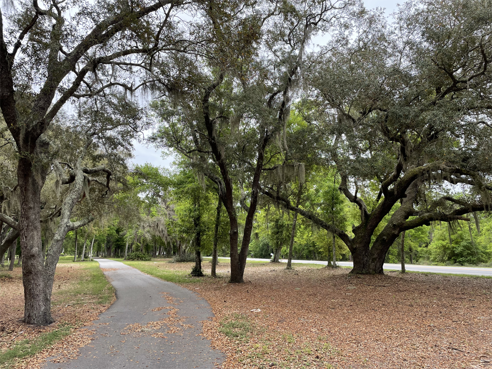
The bike path took us all the way through town and across a small state park until we ended up back on the beach road about half a mile east of the hotel. Outstanding.
It was Easter Sunday and as I made my way to my room WhatsApp started pinging with messages and snapshots of the Easter Sunday chocolate surprises everyone was finding in their bags. Surprise! Me too. Another touching gesture from Dennis.
ACME Oyster House was a van drive away. "Sizzling, chargrilled oysters saturated in an herb butter sauce, topped with a special blend of cheese" of course, and probably fried alligator with creamy sriracha aioli just because we could. And since it was a bar-food kinda place I probably had jambalaya for my main course. Dave-the-Elder, Steven and I talked about music choices and since I have a memory like a sieve, Steven was later kind enough to email his recommendations.
Monday April 10 Gulf Shores AL
Rest day
Repeated icing and medicating every day seems to be holding the Achilles tendon problem at bay, which is the closest thing I have encountered to a show-stopper since my saddle sore cleared up.
I participated fully in the cyclist dream day off: bike cleaning; walk on beach; trip to bike shop; hair cut and shave; happy hour; dinner.
Starting with the bike cleaning, I wheeled my trusty steed out to the parking lot to join half a dozen folks already there with their bikes striped down. There are two extremes that apply both to horse and bike riders: the "ridden hard and put away wet" end where one spends no time at all on maintenance and the "spit and polish" end where one can spend more time on grooming than on actually riding. I have zero respect for the former, and tons of respect for the latter, but guiltily in actual practice I end up being closer to the former end. here though was a wonderful, easy, opportunity to do better. Bobby had changed my rear tire a week or so before and though the front was not as bad, it seemed silly to carry the front spare home so task one was to swap the front tire out. Bobby came over and gracefully took over while I chatted to him. Jeez I must look useless, but I was very grateful to make sure it was done properly. Finally, thankfully he trusted me to do the cleaning for myself and I made a meticulous effort to achieve a result he'd be proud of. He gave me an A- which I was very happy with.
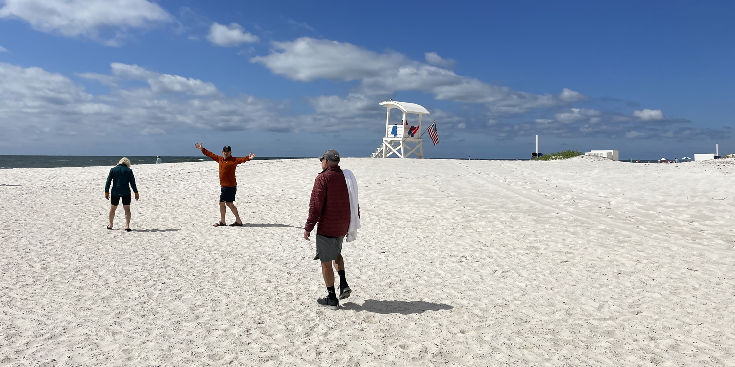
Next up the walk on the beach. Gulf Shores has some of the whitest beaches in the world, and they were right behind the hotels on the otherside of the street. In a move more befitting of Billy-Bob, Dave-the-Elder was determined to take a plunge, and a bunch of us rallied around to provide a support crew.
I never doubted him of course but I was thoroughly impressed, as we all were, as he crashed headfirst into an inbound wave. I was equally relieved a few minutes later when honor satisfied he returned to the safety of the sand, and we quickly covered him in towels.
BHDD0280-dave-plunge-375.jpg
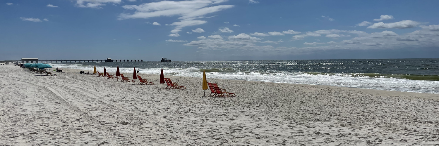
There followed a much more pedestrian (literally and figuratively) jaunt up the beach to the pier and back. Job done.
The trip to the bike shop was a fun outing with more than half the group along for the ride. Lots of people found stuff to buy, but the one thing that continues to elude me is a bike themed bottle opener. The shop owner/manager thought it was an excellent idea that he was going to look into, but of course that did not help me much on the day. On the way home we managed to find a perfect late-lunch spot: Dairy Queen on one side, burger joint on the other. Maximizing my DQ-with-Shelley count was a no-brainer choice for me and she.
Then, timing is everything, the ice cream stop meant we were passing my barber shop within striking distance of my appointment time so I had the luxury of being dropped off where I thought it was without the risk of a mile-plus walk only to discover I was in the wrong place/it was closed. The ladies pondered how much of a euphemism "hot shave" was and whether I knew what I was getting into. The "Gentleman's" part of the Gentlemen's Quarters Barbershop set their imaginations racing. They even volunteered to run interference for me. It's true I couldn't ab-so-lutely guarantee that they were wrong, but what I was certain of was that the only thing worse than my friends "helping out" would be for my mother to be that wing-person. Whatever I'd signed up for, I needed to handle on my own.
Hot ShaveEven this I had to research, because it turns out that a straight razor shave is not the same thing as a hot shave. Half a dozen barbers near me can give you a straight razor shave. Only one of them does a hot shave. So it was more by luck than judgment that the "Gentleman's Quarters Barbershop" half a mile down the beach from our hotel actually did the latter. I grabbed this from the interweb: "A hot shave naturally exfoliates your skin. Yes, exfoliating gets rid of dead skin, dirt and oil. However, the other big benefit is the fact that it helps you generate new skin cells. This makes your skin look brighter and feel healthier. Last but not least, a hot shave simply feels good. The steam calms your body and relaxes your mind. Many men say that it makes them feel refreshed, rejuvenated, and re-energized. It’s no wonder why many men visit a professional barber for a hot shave on a weekly basis." Of course the hot shave uses a straight razor, but it was the hot towel part which was such an unexpected pleasure. I only have a sample size of one, but the master stroke was placing the first hot towel over my eyes. The shock of the heat and the surprise location, and of course being forced to close my eyes focused me inwards. Two other towels then followed until the only exposed part of my face was my nostrils. Then the barber quietly went into the next room, leaving me to my thoughts. But I didn't have any, so I just lay there in a sort of meditative state. It was bliss. Eventually she came back, took all the towels off except the one over my eyes. Oils were massaged in. Since at this point in my life I have almost no hair left, she applied the oil over my whole head and as far down my neck as she could reach. Then the first shave. Then repeat the hot towels. And the oil. The second time with the razor was clearly closer and smoother. The next towels were nearly as shocking as the first, because they were cold. After that some sort of aftershave I assume. It was more cooling and one assumes helped to remove the remains of the oils in a final vigorous all over rubbing with a room temperature towel. I was stunned. It was a way more intense experience than than last week's massage. As advertized on the interweb it felt really good. It was refreshing, it was rejuvenating, I felt re-energized, and I didn't feel like moving. |
|
Doug, Kevin, Bobby and I were the only takers for dinner. We were in the mood for meat, so selected Hog Wild Beach BBQ. It was the best part of two miles away, so Bobby volunteered to drive, but we volunteered to walk so that we might twist his arm and have a beer. Actually I think Bill set off with us, but in classic Bill style he peeled off on his own adventure about half way there. I do remember that he walked home along the beach in the dark, and got some great nighttime snaps. Oh the irony. There was no Beach at the Beach BBQ, but much worse, there was no beer. There was also no going back. Half a rack of ribs for me please, with fried pickles, and BBQ Baked Beans. And then miracles, as we were ordering we noticed that the cooler included beer amongst its regular soda selections. The canteen / take-out-is-our-specialty atmosphere meant that we thoroughly enjoyed our supper but thirty minutes later we were all done. We took a more leisurely pace on the way home, and although Shelley was not with us, the sweet-toothed member of the party (naming no names, Capt. America) insisted we stopped at Matt's Homemade Ice Cream which had been highly recommended to him. It was highly expensive for sure, and I thoroughly enjoyed my raspberry sorbet, but for me by far the highlight of the expedition was quality time with the big dogs. |
|
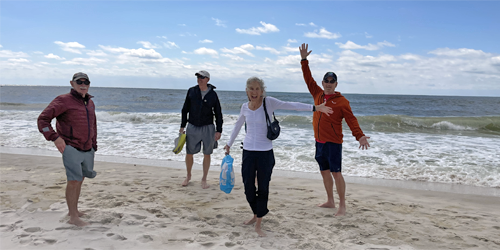
Beach: Dave-the-Elder; Kevin; Betsy; Dave-the-Younger.
|