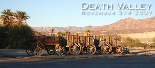
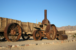
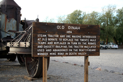
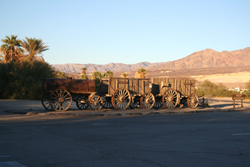
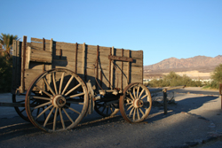
20-mule-team wagons (that's the mules hauling one in the top bar) hauled processed borax 165 miles across the desert to the railroad at Mojave.
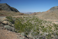
The map of Nevada looks blank at first. Closer study reveals the occasional scratching across its surface. The major scratching is Highway 93 through Las Vegas. It lists Los Angeles as its chief objective south, and Salt Lake City (452 miles) as the reason to go north (east). Another road goes northwest towards the top half of the state (and the other side of the map) and southeast towards the Hoover Dam and Arizona. The intersection of these two roads is north of Las Vegas. The airport, and the only other road on the map heading west from 93, are both south of Las Vegas. You'd think then, that while getting lost in the desert might be a real threat, by staying on the tarmac you'd be in pretty good shape.
You'd be wrong. The contestants were Ann Marie Kamensky (aka AMK), John Nikula and myself. Our excuses are that:
-
It was 2am EST
-
The Chrysler POS convertible (which was the only option left on the rental lot) was so small that we could not get ourselves and the luggage in it with the roof up. So no matter how cold it got, we needed the top down.
-
We tried to follow the MapQuest instructions, but we think these were for the terminal, not the satellite building that the rentals depart from.
We could not find a way to get south on 93. Since even we could register the fact that we were heading directly into Vegas, we eventually conceded we needed to turn around. What we were then too tired to realize was that the southbound exit we eventually found was the one we were supposed to leave 93 on. Ignoring all the evidence that we were already in the right spot, we entered the highway. Now there are two problems. First, when the next exit is not the right number, are they counting down or up? Second, given that we now need to travel two exits, how close to Los Angeles will we be before we can turn around again? It's cold.
Pahrump
Around midnight local time, we're finally back where we started, on the road to Pahrump. So far it has taken an hour to travel what MapQuest cheerily announces is just the first 18 minutes of a trip that's only supposed to take an hour in total. It's cold. It looks even colder when I turn around to check on AMK, who has insisted on riding in the back, and who is now crunched up in a little ball. John has the pedal to the metal, which means we're doing well in excess of 50 miles per hour. So hopefully we can make Pahrump in not much more than the advertised time.
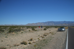
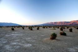
Pahrump is 40+ miles away and there is nothing but desert between Vegas and Pahrump, but over the course of the trip, we see three or four examples of pickups driving, or standing with their lights on, anywhere from 20 to 500 yards off into the desert. After some discussion, snake hunting is the only legitimate purpose John and I can imagine. But our imaginations are inclined in an altogether more sinister direction. We don't stop to ask.
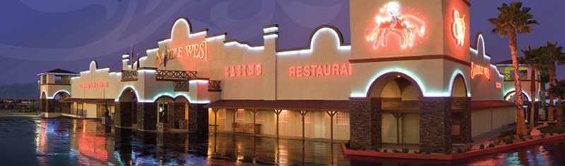
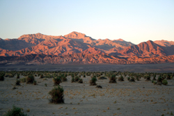
We are only about half way there when Pahrump first appears on the horizon. It looks enormous. But as we finally hit the edge of town, we see that the main blaze of lights which had looked like a mini version of The Strip, was in fact a two mile series of bill boards leading into town. And the sodium street lights off to either side seem to be lighting up a whole lot of nothin'. We don't remember the name of the hotel, but don't bother to look it up, on the correct assumption that we'll know it when we see it. Oh yeah. (This is their picture, not mine.)
 Everything about Nevada still says wild west to me. Okay, there are not too many folks sporting six-shooters and spurs, but Bugsy Malone's wild west is alive and well. Nevada makes Massachusetts look like Disney World. All vices are catered to. Las Vegas of course represents many of them, and the gambling opportunities begin within yards of stepping off the plane. But even with Vegas firmly in our rear-view mirror, one can't ignore the sexual content of the billboards, the alcohol for sale at every gas station, the number of firework stores in Pahrump, or the pickups in the desert.
This hotel is no exception. We have to fight our way through the smoke haze and one-armed bandit maze to get to the reception desk. When John had called to make sure we didn't need special instructions for our late arrival they said "oh, we'll be up" and it was true. Too tired even for a celebratory beer, we take our keys and head for our rooms.
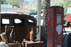
Pahrump in the warm light of day. The saloon, of course, is open. There's a strip club, two car lubes, five (count 'em) fireworks stores. Hell, courtesy of some interesting literature later thrust into my hand by a kind gentleman educating folks on The Strip in Vegas, I discover that there are even three brothels, but there does not seem to be anywhere to get breakfast. Not breakfast people I guess.
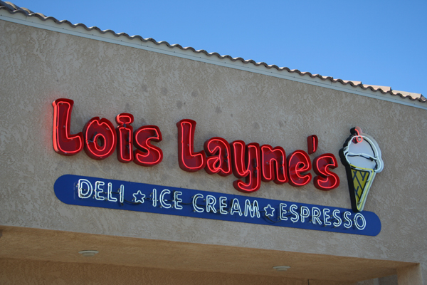
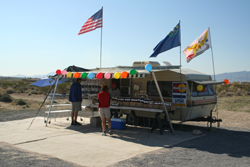
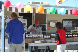
Finally, AMK spots something with potential through a break in a strip mall. So we drive through to a back street to find Lois Layne's Deli:
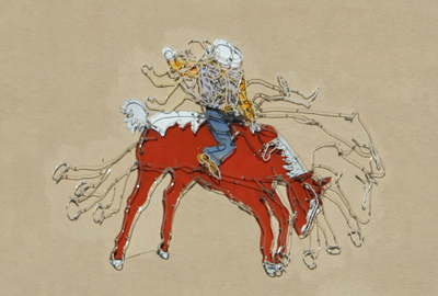
While I wait for AMK and John to order breakfast, I cross the street to check out the playground, nicely shaded by some of the only trees in town. The wild west strikes again:
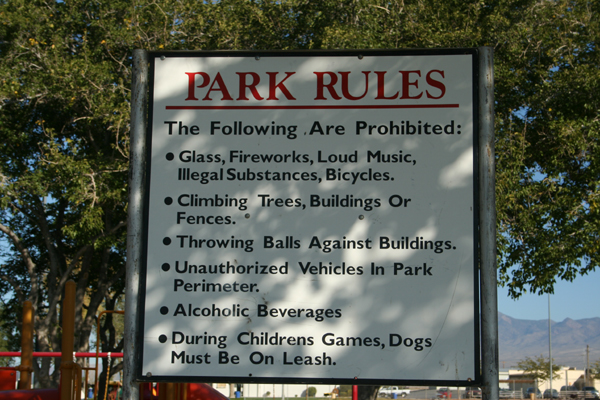
John notes that the illegal substances are further down the list than the glass and the fireworks. I eat my first egg and sausage breakfast bagel. I think we all had the same thing, except I can't believe AMK ate the sausage.
The Way In
But it is seriously time to get out of Dodge. The lack of roof is not such a hardship now. On the night drive from Vegas we spotted a turn-off about 10 miles out of Pahrump that overnight research has identified as the "Scenic Route" into the park. As we're leaving town, a curb-side vendor is selling nothing but tarps. We start to speculate again.
Maintaining our unbroken record, we sail past the turn before we realize we've arrived already, and then have to find a place where we can make a U-turn on the divided highway without ripping out the undercarriage. But first, the banners on the side of the road announcing "Jerky" then "Good Jerky" then "Best Jerky in State" reel us in. We're on a no-stop-too-frequent-or-too-inconsequential tour, so John votes to stop.
And now there are enough pictures to let them do the talking. Just click on a thumb-nail to enlarge the view.
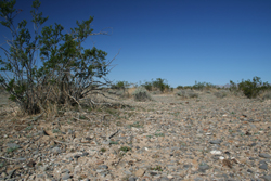
When we pulled off the road to take these first pictures, John and AMK made a really quite disturbing discovery: the very tattered remains of a tarp mixed up with the equally tattered remains of something mammalian. Suddenly our wild speculation didn't seem so wild. Noone wanted to connect the dots so we got back in the car and drove off in silence.
Shosone, the last town before the park. They are having some kind of fair, but it is not clear what the common denominator is. Veteran cars? Veterans? There was a band, local history exhibits, farm stand from the local date farm and several stands of "local" art that looked like first graders were supplying the vendor. We bought fresh dates and bottled water. Lots of it.
Death Valley National Park
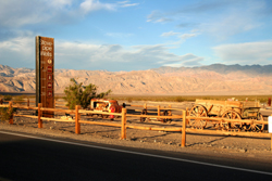
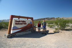 Finally we find the park.
Perhaps not a coincidence, this sign looks just like the one I photographed last Vegas trip, at the entrance to the Mojave Desert.
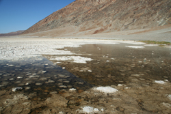
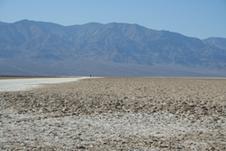
John: "salty."
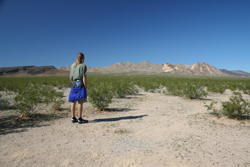
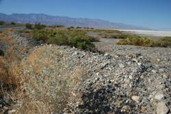
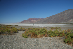
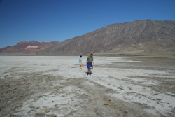
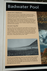
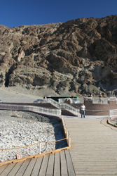
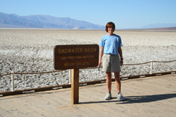
Badwater
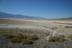 Well you can definitely tell we've hit a tourist spot. Suddenly, after 50 miles of totally open road, there's a parking lot, barriers, wheelchair ramps, and a tourist bus. Oh, and a ticket machine, asking for a $20 "Park Entry fee." In hindsight, this was well worth it, but it seemed like a lot of money to be feeding into a box in the middle of nowhere, and I notice, regretably, that noone else seems to feed it while we are there. Where did all these people suddenly come from? Where did they disappear to afterwards?
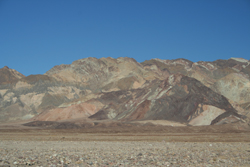
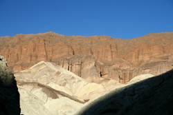
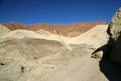
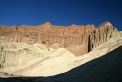
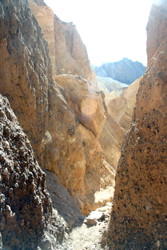
Golden Canyon
Back on the road, it is not long before we see a tour bus and several other vehicles parked in a small lot just off the road. Golden Canyon the sign says, and I remember that this was one of the trails I had read about somewhere in our reference material. We pull over, re-read the notes, and agree that a one mile trail (two there and back) was doable and agreeable.
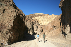
Golden Canyon Trail
Length: 1 mile, one-way.
Difficulty:.easy
Start: Golden Canyon parking area, 2 miles south of Hwy 190 on Badwater Road.
Description: Easy trail through colorful canyon. Red Cathedral located ¼ mile up canyon from last numbered marker. Interpretive trail guides are available.
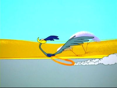
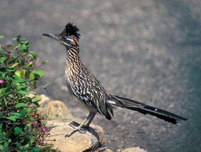
Other than Stovepipe Wells' ravens, right here is where AMK claims she saw the only fauna of the trip: a road runner, spotted sucking water dripping from the bottom of an RV. I'm bummed I missed it, so I have to steal another picture to illustrate what I missed:
We were not so sad to miss the rattlesnakes that it hunts, or the coyotes. The burros and big-horn sheep might have been nice but I suspect without binoculars and powers of observation well beyond my own, we'd've missed them even if they were in our view. We didn't even see the much more common kangaroo rats or chuckwallas, though I think I saw their tracks in the dunes.
.
Furnace Creek
Back on the road we're now close to Furnace Creek. We'd seen this oasis in a documentary, and found it hard to believe, but here it was in real life. Slap in the middle of the valley, there are palm trees, grass, sprinkler heads.
Wikipedia has this to say:
"Furnace Creek is a census-designated place (CDP) in Inyo County, California, United States. The population was 31 at the 2000 census. The elevation of the village is 179 feet below sea level, making it the lowest census-designated place in the United States.
At Furnace Creek is the headquarters of Death Valley National Park, as well as two of its major tourist facilities, the Furnace Creek Inn and Ranch Resort. The golf course attached to the Ranch is the lowest in the world, at 214 feet below sea level. Most lodging is closed in the summer, when temperatures in the vicinity can surpass 125 degrees Fahrenheit (52 degrees Celsius). [...]
[In fact] Furnace Creek has the distinction of holding the record for the highest ever recorded temperature in the United States, as well as the highest ever reliably recorded worldwide, reaching 134°F (56.7°C) on July 10, 1913.
I'm not much of a geologist, but the alluvial fan that Furnace Creek sits on is pretty amazing, if only we'd been high enough to see it.
We need to stop here for two reasons. First and foremost we need to check if they have a TV system capable of receiving the Pats-Colts game on Sunday. Affirmative. Second we need to check in at the Ranger Station to validate our Park Entry Fee Receipt. The Rangers seem thrilled to see us. I guess they don't get a lot of visitors, and fewer still who ask them questions. Their rather incongruous LLBean thermometer shows 105° but I'm not sure I trust Mainers to register high temperatures accurately. That said it is definitely hot enough, especially for November.
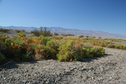
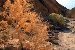
Sunset at Devil's Cornfield
We're making good progress towards Stovepipe Wells and a well-earned beer, when two things happen simultaneously. The light made that sudden glorious change it makes as the sun goes down so that everything seems to glow. And a brown camera road sign says "photo op." Not ones to argue, we obey the instructions.
The Devil's Cornfield derives its name from a species of arrow weed (Pluchea sericea). As sand dunes gradually built up around them, these plants kept alive by outpacing the rising dunes. Eventually the dunes passed by, exposing the tall root systems of these amazing plants. The ones in this view are over 6 feet (2 meters) tall. Abundant ground water just below the surface keeps the arrow weed thriving here in the midst of extraordinarily harsh conditions. As the common name implies, the plant's woody stocks were used by Native Americans to make arrows.
Stovepipe Wells
This hotel is in stark contrast to last night. We might be in country so barren NASA uses it as a Mars simulator, but it is still immediately obvious we're in California not Nevada.
The whole "village" has a cared-for sort of feel. The main restaurant complex is a respectful construction built from renovated mine timbers and hardware. The corridor connecting the restaurant from the saloon is made out to be a mine-shaft. The food is plain but perfect, and they have a good selection of beer. Meaning they have stuff we haven't heard of so we need to try it, and they have Sierra Nevada which we know and can happily switch to after doing the Fat Tire due diligence.
After a long day on the road, and with a mouth that has that gritty taste that it has after a day on a windy beach, the beers slipped down very easily, and even AMK had a couple.
Mesquite Sand Dunes, Stovepipe Wells
We actually visited the sand dunes three times. The first time, at sunset on the way in to Stovepipe Wells. After dinner, and several beers, AMK drove us back out there to watch the stars. We lay on our backs for 15 or 20 minutes with nothing to say. The sky was packed with stars. Enough light to see by. The Milky Way drifted like smoke across the whole middle section. We all saw shooting stars. We got back into the car. John: "wow." We went to bed.